
Gümüşhane
- Black Sea Region
About Gümüşhane
Gümüşhane, in the east of the Black Sea Region, covers 6,575 square kilometres and is home to 146,353 people. It is bordered by Bayburt to the east, Giresun to the west, Trabzon to the north and Erzincan to the south. It stands out both for its rich history and remains and for the natural beauty that stretches along the valley on both banks of the Harşit stream.
Gümüşhane, known for the wealth of its silver mines over thousands of years, takes its name from the Turkish word “gümüş” (silver) and the Persian word “hane” (house). In the Roman period the city was called “Argyropolis”, meaning “place of silver”, and Evliya Çelebi described it as “Gümüşşehri” (Silver City). Its position on the Silk Road, the great trade route of the past, also made it an important centre throughout history. For example, the mints in old Gümüşhane struck silver and gold coins that supplied 1/6 of the imperial treasury, and the city's right to mint coins in its own name was another privilege. Gümüşhane, ruled over history by many cultures such as the Assyrians, Urartians, Medes, the Persian Kingdom, the Macedonians, the Kingdom of Pontus, the Roman Empire, the Umayyads and the Seljuks, came under Turkish rule in 1461, when Fatih Sultan Mehmet (Mehmed II) brought down the Greek Empire of Trebizond (Pontus).
Thanks to this multicultural past, today's Gümüşhane has 391 registered immovable cultural assets, such as ancient cities, bridges, hamams, monasteries and churches.
The Gümüşhane area is a magnet for yayla (highland pasture) tourism. The Kadırga, Güvende, Kazıkbeli, Erikbeli and Taşköprü yaylas are true wonders of nature. Every summer these yaylas host festivals, with large markets and all kinds of entertainment. Gümüşhane is one of the areas where the yayla culture of the Black Sea Region is most alive. These yaylas also have cultural value, both because they bring together the surrounding obas (herders' encampments) and because they are linked to historical figures or objects.
Gümüşhane's famous dishes and desserts
Gümüşhane's food culture also goes back a long way. No comprehensive research has yet been done on it, but the richness, flavour and skill in its kitchens today show this.
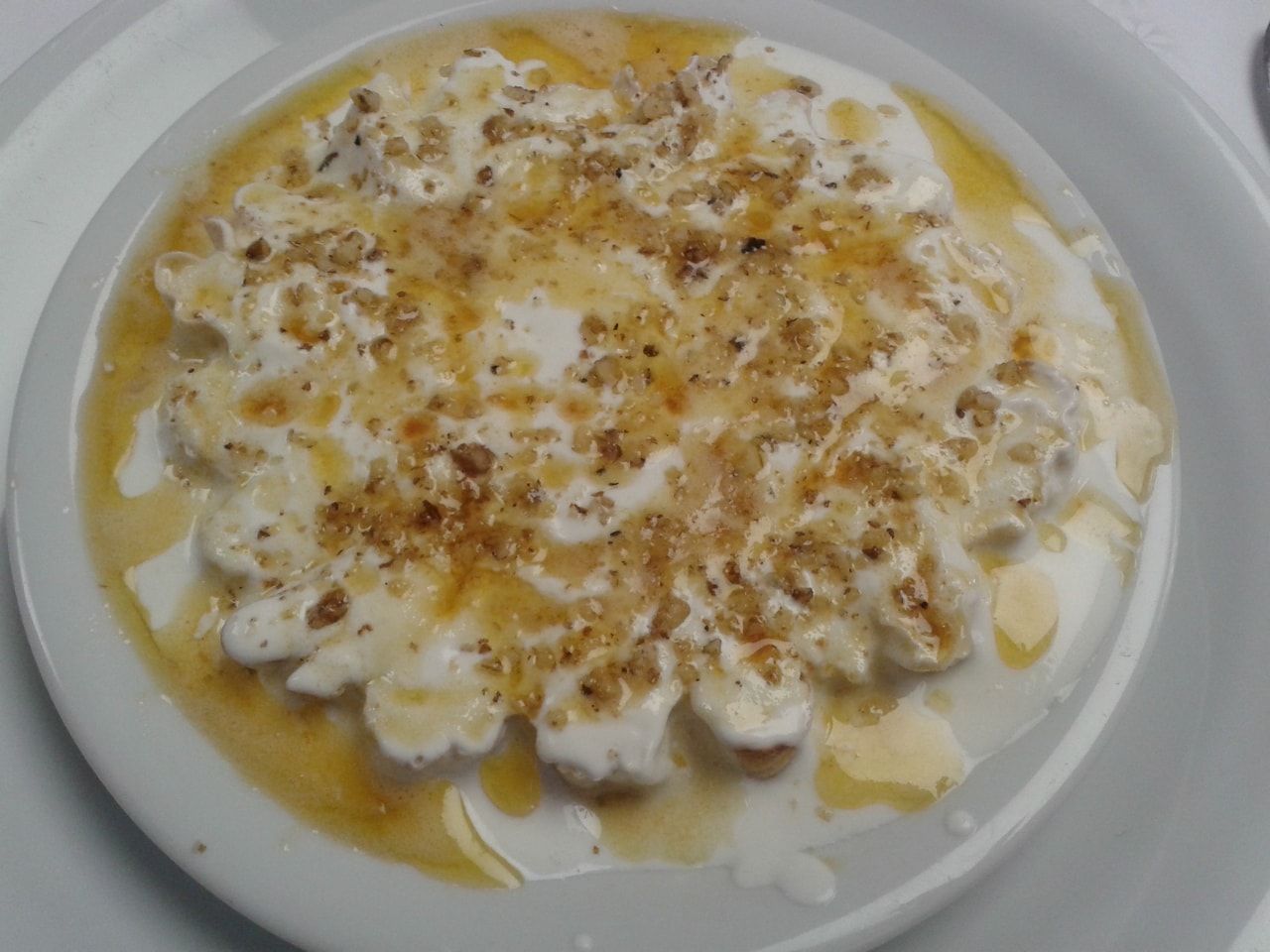
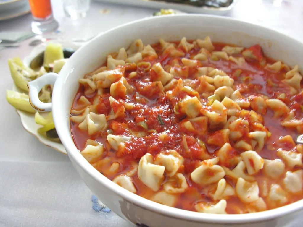
Siron
Made with yogurt or strained yogurt and served with a butter and walnut sauce. Being light, it is a favourite of summer tables. It is one of Gümüşhane's geographical indication products and is often eaten at iftar and sahur (the meals that break and precede the Ramadan fast).

Places to visit in Gümüşhane
Limni Lake, Gümüşhane
This lake is on the Saronay yayla (highland pasture) in Gümüşhane's Torul district. At 1,700 metres, its wonderful view leaves you in awe. Limni Lake lies at the foot of Mount Zigana. You can visit it in both summer and winter, and it is like air conditioning, with spotlessly clean air. Limni Lake is 40 kilometres from the provincial centre and 16 kilometres from the district centre, and it is easy to reach. Be sure to see this lake, reached through a forested area.
Kov Castle, Gümüşhane
Kov Castle is one of Gümüşhane's symbols and the most magnificent castle in the Eastern Black Sea Region. Built in the Seljuk period, it is now used as a climbing platform. The main gate of Kov Castle is on the west, and the surfaces of its walls are finished with lime and sand. Built to meet every basic need, it is a castle you should see too.
Satala ancient city, Gümüşhane

Satala is an ancient city in Gümüşhane's Kelkit district, 17 kilometres from the district centre. Its bricks bear the emblem of the Legio XV Apollinaris. It grew up around a Roman legion camp and in the same period served as a centre of Latin culture.
Karaca Cave, Gümüşhane
This cave, in the village of Cebeli in Gümüşhane's Torul district, has many stalactites, stalagmites, columns and patterned walls. The most interesting thing about Karaca Cave is that it is good for many respiratory illnesses, asthma above all.
The cave is 17 kilometres from the provincial centre and 1,550 metres above sea level. Around the cave there are facilities such as a rest area and a country café. Karaca Cave is one of our country's wonderful natural beauties.
Tomara Waterfall, Gümüşhane

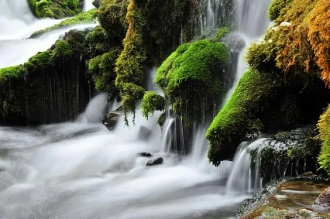
This waterfall is in the village of Seydibaba in Gümüşhane's Şiran district. All its water comes from underground, and the differences in height give it a beauty of its own.
Zigana Ski Centre, Gümüşhane

At this ski centre, set mostly in forest, the skiing area ranges from 1,900 to 2,500 metres. The ski season starts in December and runs until April. The centre has one ski lift and one baby lift, and the snow can be up to 1.5 metres deep.
The 661-metre run is between 100 and 200 metres wide. You will never have trouble finding accommodation at the Zigana Ski Centre.
Don't leave Gümüşhane without…
* joining the festivals held every June, July and August,
* touring the Taşköprü yayla and having a meal there,

* stopping at the Santa ruins,

* skiing at the ski centre on Mount Zigana.
Culture and arts in Gümüşhane
Gümüşhane's nature is also part of its culture. Mount Zigana and the Zigana Pass rise like a natural wall between Gümüşhane and Trabzon. The Karaca Cave in Torul is known for its stalactites and stalagmites, and the Taşköprü yayla in Kürtün is a stop for those who want to see Black Sea yayla culture up close.
In its cuisine, Gümüşhane bears the marks of Black Sea cooking. It is known for dishes such as siron, fasulye diblesi (a bean dish) and fındıklı un helvası (flour halva with hazelnuts).
History of Gümüşhane
A true mosaic of peoples formed in the Gümüşhane region, which stretched from Skidides, where the Bizer and Muşki lived, in the east, to the Pariyadres mountains in the west, and was bordered by the Satala (Sadak) plain to the south. Finds from research help shed light only on the Early Bronze Age, dated to 3000–2000 BC. Because its geographical position always left Gümüşhane as a buffer zone in historical events, most of its architectural works have not survived.
Silver is often named in Cappadocian written sources as a source of wealth and the subject of intense trade; because of heavy extraction in the Assyrian colony period, the deposits lost much of their richness, and the traces of ancient mining have almost been erased.
In Hittite times, when the Gümüşhane area was known as the land of Azzi and the lands to its south as far as Suşehri as the land of Hayasa, silver was again the source of wealth. The Hittites used silver as the measure of value in trade.
When the Hittite Empire weakened under attacks from the Phrygians coming from the west and from its northern neighbours the Kaskians, the Urartians took control of the region (860 BC). Taking advantage of Assyria's weakening, the Urartians increased their influence in the region. In the same years the Argonauts, who traded in the Aegean islands, founded colonies in the mining area of the Black Sea, which they called “the hostile sea that does not welcome guests” (756 BC). So the mines of the Gümüşhane area were also opened up to civilisation, and with this, Urartian culture and metalworking spread through the Argonauts as far as the Aegean islands.
In the 560s BC the Medes captured the Gümüşhane area. But the Medes were overthrown by the revolt of Cyrus II (Kuraş) of the Achaemenid dynasty, from the same lineage, and in 550 BC the Persian Kingdom was founded. Gümüşhane was within its borders and was obliged to pay a tax of 300 silver talents a year. The Persians also used local people in their wars with the Greeks: Khalyb soldiers (Khaledi–Haldi, a people said to live around Gümüşhane, Trabzon and their surroundings) joined Xerxes' campaign against Greece in 480 BC. Herodotus writes that in this campaign the Khalybes were armed with small shields, short spears and curved swords. Some sources record that the Muşki living in the Çoruh basin took part in this campaign.
The historian Xenophon, who travelled through the region from south to north in the reign of Emperor Artaxerxes II (400 BC), writes that the Macedonians serving as mercenaries in the Persian army were defeated by the Karduchoi in the Babylon area, and that during the retreat that followed they also passed through the Gümüşhane area.
The Persian Empire, which began to weaken in the 350s BC, was brought to an end by King Alexander the Great of Macedon (334 and 331 BC). Alexander's armies did not reach the Gümüşhane area, so at the start of the 4th century BC the area fell into a political vacuum. It is said that Flikos, one of Alexander the Great's governors, found a silver mine in Gümüşhane and gave the place importance. Mithridates Ktistes, tyrant of the Aegean island of Kios, seized lands reaching east to the basins of the Iris (Yeşilırmak) and the Lykos (Kelkit) (301 BC). After Mithridates I, founder of the Kingdom of Pontus, died, his sons succeeded him. Hundreds of castles were built to maintain defensive superiority. When the army was in difficulty, this mountainous region also made a good hiding place. When Pontic supremacy was shaken at the battle of Kerona, internal unrest began, and after defeat in the second great battle with the Romans around Kabira near the Lykos (Kelkit), they withdrew to the mountains of Gümüşhane. Roman rule in the area began in 20 BC and lasted until around AD 395. When the Roman Empire split into Eastern and Western Rome as a result of the Migration Period, the Gümüşhane area remained within Eastern Rome (Byzantium).
In the Byzantine period the Gümüşhane area also played an important role in Byzantine–Khazar military cooperation. Under Emperor Justinian, Keçi Kale Castle (in the Kale subdistrict) was repaired.
In the Roman and Byzantine periods the city in the area was called Argyropolis. The main reasons for the wars in the area were that it lay on the historic Silk Road and was famous for its mines. In the 7th and 8th centuries the region changed hands several times.
When Erzincan and Erzurum fell to the Arabs under Caliph Omar (634–644), Gümüşhane also recognised this rule. Changing hands from the time of Caliph Uthman through the Umayyads and Abbasids, the area passed to the Turks during Çağrı Bey's first raid into Anatolia in 1016.
After the Battle of Manzikert (Malazgirt) in 1071 the area came under Seljuk rule, and finally in 1467 the Akkoyunlu ruled the area.
With Fatih Sultan Mehmet's (Mehmed II's) end of the Greek Empire of Trebizond in 1461, Ottoman influence began to be felt in the region. After the conquest of the Empire of Trebizond, Gümüşhane came under Ottoman rule, which lasted from 1461 to 1467. After that, Gümüşhane came under the Akkoyunlu, whose rule ended with the Battle of Otlukbeli between Fatih and Uzun Hasan in 1473. In 1514 it was taken for good by Yavuz Sultan Selim (Selim I) and joined the Ottoman lands.
Kanuni Sultan Süleyman (Suleiman the Magnificent, 1520–1566), passing through the Harşit Valley on his Iran campaign, ordered the development of old Gümüşhane, where the silver mine was, and so 50 houses and the Süleymaniye Mosque were built there. The Ottoman–Russian War of 1877–1878, the Russian occupations of Eastern Anatolia and the Eastern Black Sea on 7 July 1916, and the migrations that followed left no life in Gümüşhane. After taking Bayburt on 16 July 1916, the Russians pressed on and entered Gümüşhane on 19 (20) July 1916. As the Turkish units could not put up much resistance, the Russians entered Torul the same day, opening the Trabzon road to them.
On 22 July 1916 the Russian army marching on Kelkit took it towards evening. While Gümüşhane and its surroundings were being crushed by these occupations and especially by Armenian persecution, the outbreak of the Bolshevik revolution and internal turmoil in Russia led the Russians to sign the Erzincan armistice on 18 December 1917 and agree to withdraw their armies. But the Armenians continued their massacres. The armistice was then declared void, war began again, and so Torul was liberated from Russian occupation on 14 February, Gümüşhane on 15 February and Kelkit on 17 February 1918. The sanjak of Gümüşhane, attached to the province of Erzurum in early Ottoman times and later to Trabzon, became a province in 1925 under Article 89 of Law No. 491 of 20 April 1924, under the heading “Vilayet”. The Trabzon salname (yearbook) of 1925–1926 states that “the Province of Gümüşhane consists of 5 districts, the central district together with Bayburt, Kelkit, Torul and Şiran, 5 subdistricts and 377 villages; 101,153 people live in 16,943 houses, and the city has no hospital…
It says that the province's trade was quite good because it lay on the great Trabzon–Bayburt–Erzurum road and the Iran transit road, and that, since the province, essentially an agricultural land, did not produce enough in some places to meet local needs, some of the people earned their living from labouring, fruit growing and mule driving.” When Gümüşhane became a province, Ahmet DURMUŞ (Evren-Dilek) Bey was appointed governor. The first mayor of the Republican period was Osman Bey (Ataç), who served from 1922 to 1934. The administrative divisions changed when Bayburt became a province in 1989 and new districts were created: Köse became a district in 1988 and Kürtün in 1990. During Mustafa Kemal Atatürk's presidency, importance was given to building roads and bridges in Gümüşhane, and efforts were made to develop farming.
Source: http://www.gumushane.bel.tr/gumushane-rehberi/gumushane-tarihi/
Getting to Gümüşhane
The easiest way to reach Gümüşhane is by road. The city has three road links: towards Trabzon–Rize–Artvin, Erzurum–Erzincan and Giresun–Ordu–Samsun. The provincial border is 1,108 kilometres from Istanbul, 1,368 from İzmir, 788 from Ankara and 1,118 from Bursa.
For the convenience of those travelling by bus to Gümüşhane, the bus station is in the city centre. It can be reached from big and small cities with many travel agencies and bus companies.
To fly to Gümüşhane, the nearest airport is in Trabzon, 100 kilometres away.
Districts of Gümüşhane
- Kelkit
- Köse
- Kürtün
- Merkez (central district)
- Şiran
- Torul
Economy of Gümüşhane
The city's name comes from the silver mines nearby. In Ottoman sources the settlement appears as Gümüşhane from the 17th century on. A mint opened in the early 17th century; in the 18th century the mine shafts flooded and mining stopped. A company that obtained the operating rights in 1883 also found the mine uneconomic and stopped work.
Today the economy of the provincial centre relies mainly on services and trade. Farmland is limited; orchards on the floor of the Harşit Valley stand out. The city has many businesses making pestil (fruit leather) and köme (walnut sausage), and places producing rosehip marmalade and fruit juice.



Comments
Loading comments…