
Ağrı
- Eastern Anatolia Region
About Ağrı
Ağrı, one of Türkiye's easternmost provinces, lies in the country's Eastern Anatolia Region. The province takes its name from Mount Ağrı (Ararat), Türkiye's highest mountain, which stands in the region. Ağrı became a bucak (sub-district) in 1834, a district in 1869 and a province in 1927.
Ağrı's famous dishes and desserts
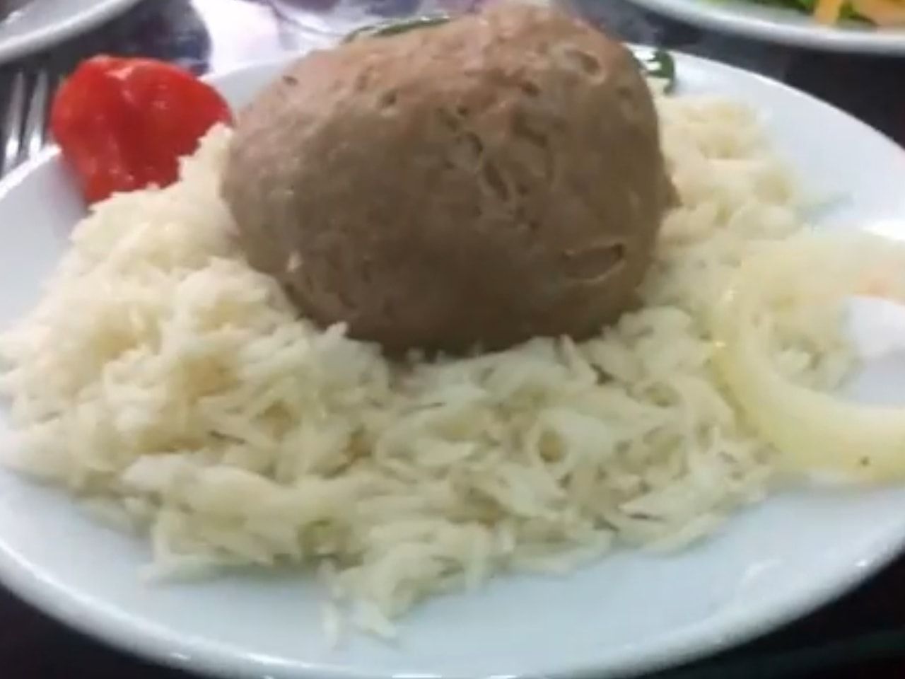
Abdigor köftesi
A well-known meatball of Ağrı, especially Doğubayazıt. The meat is said to be pounded by hand rather than put through a mincer, and the köfte is served with pilaf.
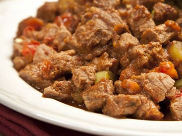
Goşteberg et
Lamb is mixed with onion, butter, tomato paste and a local herb called goşteberg, packed into a skin, covered with damp earth and cooked slowly under the fire.
Selekeli (saç kavurma)
A local saç kavurma (meat sautéed on a convex iron griddle) made with lamb or kid and associated with Doğubayazıt.
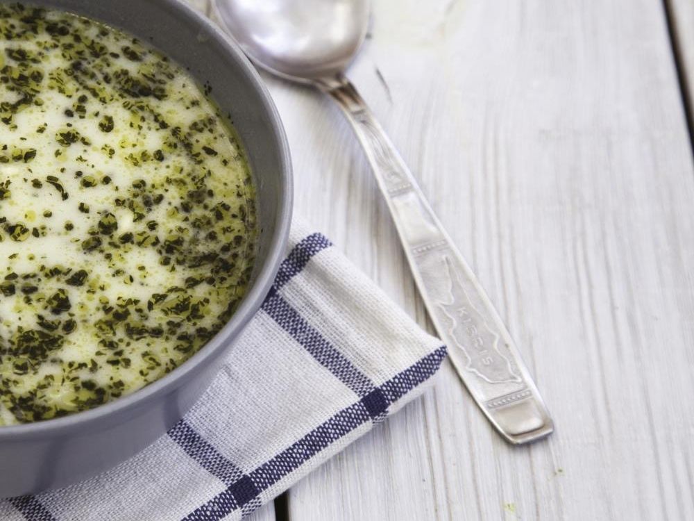
Ayranaşı
A soup-like, yoghurt-based dish made with boiled wheat and chickpeas and seasoned with salt and mint.
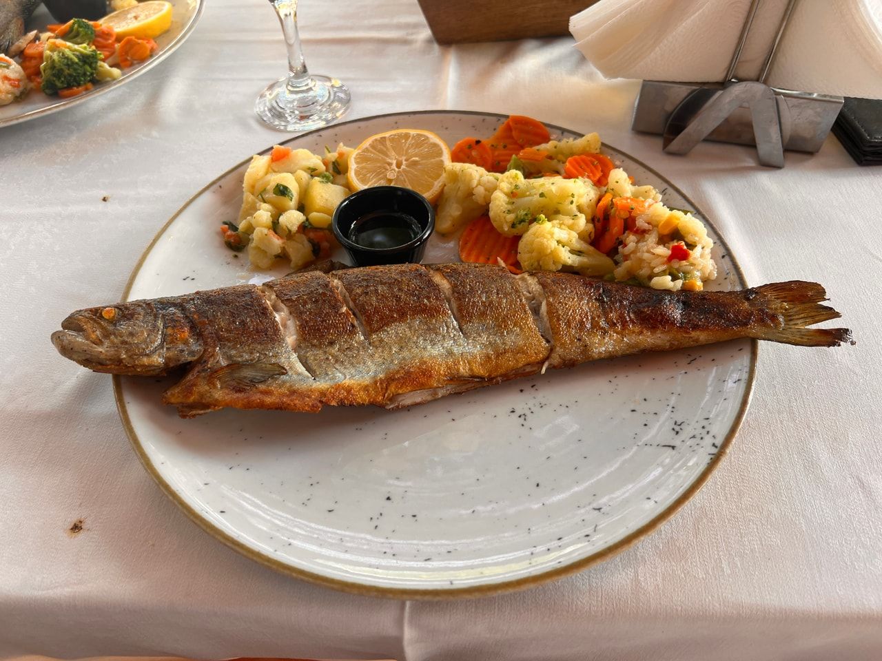
Alabalık (trout)
Balık Gölü and the streams and brooks around it are rich in red-spotted trout. The fish are fried or steamed locally.
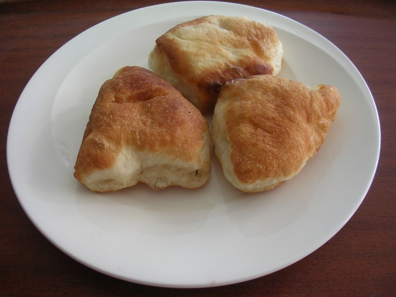
Pişi (bişi)
A pastry made by pulling pieces off a yeasted dough, shaping them and frying them in hot oil.
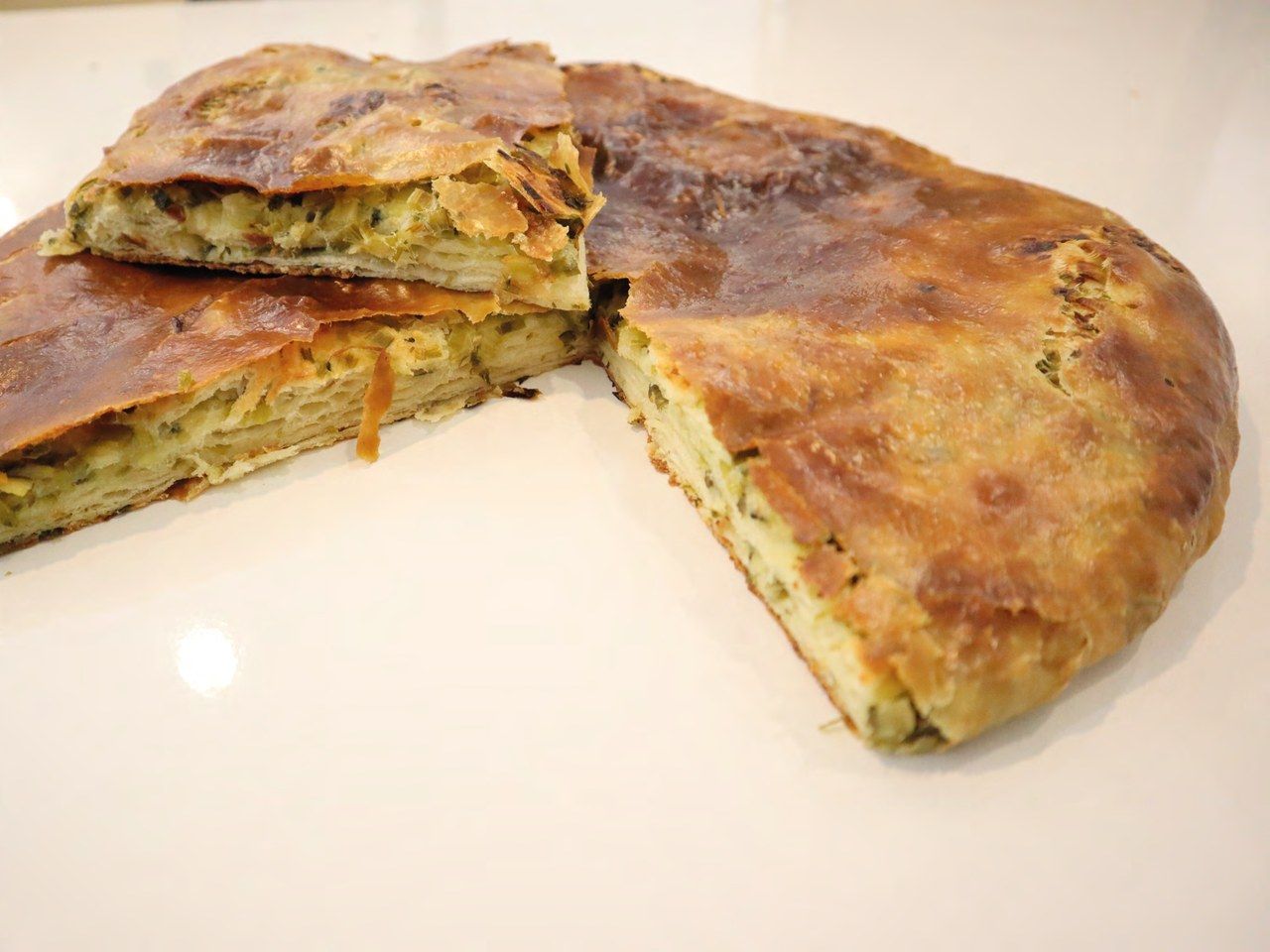
Ağrı çiriş ketesi, as served
Kete
Ağrı kete is cooked on a saç griddle and is mostly eaten at breakfast with tea.
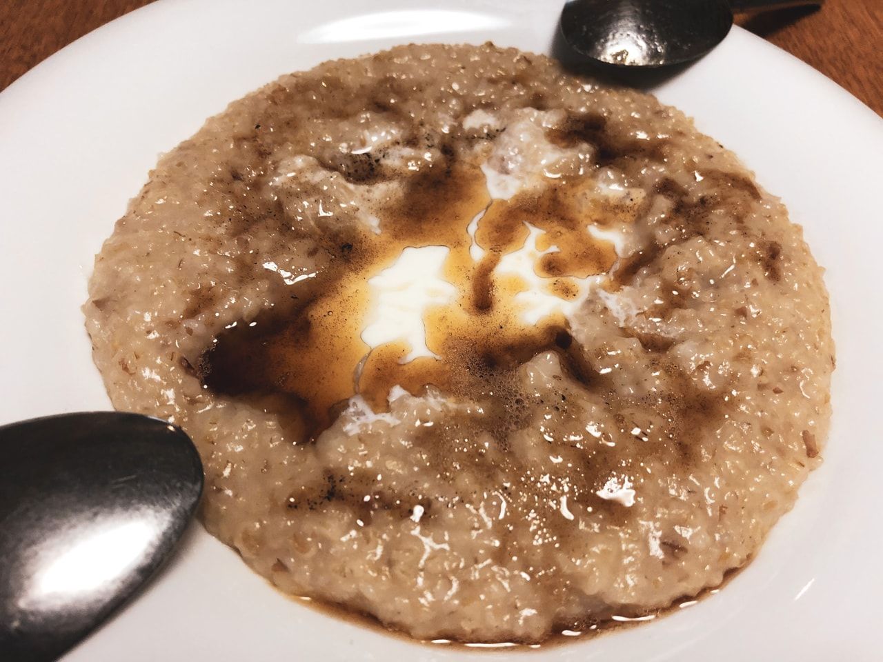
Haşıl
A wheat-based dish served with garlic yoghurt and a knob of butter in the middle, often eaten from a shared bowl.
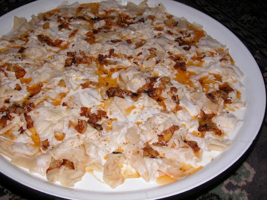
Hengel
A manti-like dish of boiled dough, eaten with garlic yoghurt or a local sauce.
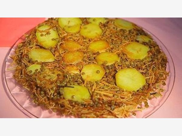
Erişte (noodles)
Home-rolled and hand-cut noodles cooked with green lentils, with potatoes added if you like.
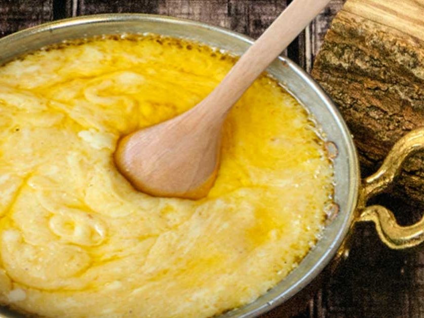
Kuymak
A hot dish made with cornmeal and wheat flour and eaten as a dessert.


Beyaz bal (white honey)
A blossom honey produced on Ağrı's highland pastures; it is called white honey locally because of its pale colour.
Places to visit in Ağrı
Castles of Ağrı province
Doğubeyazıt Castle
It stands 5 km east of Doğubeyazıt, at a place called Belleburç north-east of Old Beyazıt. Today it is in ruins. Its builder and patron are unknown; the castle contains Urartian tombs and remains from antiquity. In plan the castle has three parts. The middle part contains a temple and caves. The walls that surrounded the castle have disappeared completely. The castle is thought to have been built by the Urartians.
Diyadin Castle
It was built on the rocks on the bank of the Murat River, south of the centre of Diyadin. Its builder and patron are not known. Evliya Çelebi states that it was built by Ziyaüddin, son of Uzun Hasan. In its construction and materials the castle resembles Urartian castles. It was repaired in many periods and is in ruins today.
Koçbaşı Castle
Also known as Koçbaşı Kalesi, the structure lies 29 km from the centre of Diyadin, in the hamlet of Yankaya (Ali Hido), on a high point of Aladağ. Because its stones were taken away for house building, only its foundations survive today.
Kuje Castle
A small castle near Avnik Castle. Only its remains survive.
Tokluca Castle
It is in the village of Tokluca, 19 km from the centre of Diyadin. The structure has stairs leading underground, but where this stepped passage leads is unknown.
Havaran Castle
It was built on a steep rock 100 m above the stream that runs through the centre of Hamur. The castle dates from the last years of the Seljuk state. It was damaged in the Ottoman–Russian wars and later.
Şoşik Castle
A castle built in the village of Karlıca (Şoşik) in Hamur, 34 km from the district centre. Although its construction date is unknown, it is thought to date from the Akkoyunlu.
As it stands today, two rooms and a bath have survived; the other parts are destroyed. Stairs of block stone lead up to the castle. Below the castle there is a separately built place of worship.
Karlıca Kız Kalesi (Maiden's Castle)
It is in the village of Karlıca, 2 km east of Şoşik Castle. The lord of Şoşik Castle is said to have built it for his daughter.
Kan Kalesi
It lies near the village of Dönertaş (Kalekul), 15 km west of Tutak. Its construction date is unknown. The castle is in ruins and survives only at foundation level. Another name for the castle is Kale-i Hum.
Zencir Kale
It stands on Mount Katavin near Tutak. Its construction date is unknown. There are many legends and tales about the castle, which is in ruins today.
Diyadin Castle:
Built on the rocks on the bank of the Murat River in the centre of Diyadin, the castle was, according to Evliya Çelebi's Seyahatname, built by Ziyaüddin, son of the Akkoyunlu ruler Uzun Hasan. In fact its materials and construction show that it was built by the Urartians. It was repaired under the Akkoyunlu, the Karakoyunlu and the Ottomans.
Şoşik Castle
A castle built on steep rocks in the village of Karlıca, 35 km from Hamur. It is not known exactly when or by whom it was built, but Evliya Çelebi's Seyahatname says it "was built by Ziyaüddin, ruler of Azerbaijan". Inside the castle there are a place of worship, a bath, a watchtower, dungeons and a water tower. The castle was repaired under the Karakoyunlu.
Kızılziyaret Castle
It is in the village of the same name near Balık Gölü. When it was built, and by whom, is unknown. Because the area was abandoned in 1918 and the shelter and castle walls were damaged, the castle is in ruins.
Küpkıran (Harabegöl) Castle
It lies between the villages of Yukarı Küpkıran and Güneysu, 20 km from the central district. The castle is also known as Harabegöl Castle. Who built it, and when, is unknown.
Pazı Castle
The castle between the villages of Küpkıran and Kalender. Pazı Castle is also known as Eyüp Pasha Castle. Built on a hill overlooking the Ağrı Plain, the castle is small and simple in structure. It is badly damaged and almost unrecognisable.
Toprakkale
An ancient city 14 km from Eleşkirt. The construction date of Toprakkale is unknown, but it is thought to date from the Urartian period. It is known that the Urartians built a castle here and that the lesser Arsacids rebuilt it. The temple and settlements have been completely ruined; the castle towers and some wall remains survive.
Mount Ağrı (Ararat)
Mount Ağrı, Türkiye's highest mountain, is a legendary mountain because of its geology and because it is said to have hosted Noah's Ark after the Great Flood. Mount Ağrı, which is mentioned in the holy books, has many names in different languages. The main ones are Ararat, Kuh-i Nuh and Cebel ül Haris.
According to the records, the first ascent of the mountain, which Marco Polo said could never be climbed, was made on 9 October 1829 by Prof. Friedrich Parrot. The second winter ascent was made long after the first, on 21 February 1970, by Dr Bozkurt Ergör, a former president of the Mountaineering Federation. In the 1980s thousands of climbers visited Mount Ağrı. Climbing the mountain was banned in 1990. The ban was lifted in 1998, when the Mountaineering Federation gave permission to a group of climbers.
Height: 5,165 m.
Location: it rises in Eastern Anatolia near the Iranian border (between the Aras and Murat rivers).
Climbing season: the best months for climbing are July, August and September. Winter climbs are hard but rewarding.
Features: Mount Ağrı (5,165 m) is the highest summit of the Anatolian peninsula and of Europe. It is a volcanic mountain, made of basalt up to 4,000 m and of andesite lavas above that. There is an ice cap on the summit. On its eastern face lie the Serdarbulak plateau and Little Ağrı (Küçük Ağrı), 3,896 m high. With its height, glaciers, people, varied landforms, and the grasslands and mountain meadows that reach up to the snow line, Mount Ağrı is a striking and attractive sight.
Transport and accommodation: the international Trabzon–Erzurum–Tehran highway skirts the foot of Mount Ağrı on its way to Iran. There are regular air, rail and road links between Ankara and Erzurum.
The nearest town to the mountain is Doğubeyazıt, which can be reached from Ağrı and Erzurum. There are hotels and restaurants in and around the town.
Climbing
Equipment: crampons, rope (11 mm), ice axe, safety gear (perlon, ice screws, etc.)
For summer climbs: a sleeping bag rated to −5 to −10 °C, an anorak, a windproof jacket and other camping gear and supplies. Climbs of Mount Ağrı and Little Ağrı require a permit, and climbers must set out from the following points.
* Climbs of Mount Ağrı may only be made on the side of the mountain within Doğubeyazıt's boundaries, on the Doğubeyazıt – Topçatan village – Eli farm route.
* Little Ağrı may only be climbed by the north-west route. The southern route is the easiest and most used route to the summit of Mount Ağrı in terms of communications, transport, safety and climbing.
* Climbers staying in Doğubeyazıt complete their preparations there and drive to the village of Eli. After taking on water here, a 7–8 hour walk brings you to the first camp at 2,800 m, where you spend the night. On day two a 4–6 hour climb brings you to the second camp at about 4,200 m. Crampons, an ice axe and rope are compulsory for the summit climb. The summit is reached after an 8–10 hour climb, and you return to the first camp at 2,800 m.
Ağrı – Mount Bubi
The ski centre in Ağrı province, Eastern Anatolia, has been built on Mount Bubi, 18 km from the centre of Ağrı.
Getting there: there are flights from Ankara and Istanbul on certain days of the week. The town centre, 18 km away, can be reached by private vehicle.
Geography: the ski centre has a continental climate, and the best skiing season is December to April. The centre is covered with alpine meadows, and the snow is 1–2 m deep in the ski season.
Accommodation and other services: a ski lodge belonging to the Ağrı Special Provincial Administration has opened. There is a 60-seat cafeteria at the centre.
Lifts and pistes: the ski centre has a 1,227 m T-bar lift with a capacity of 600 people an hour. A detachable four-seat chairlift has also been built 45 km from Ağrı and 4 km from Eleşkirt. The lift is 1,650 m long with a capacity of 1,000 people an hour.
Meya (Günbuldu) Caves
They are in the village of Günbuldu, 12 km from the centre of Diyadin. In this settlement, which looks like an ancient city, the caves and historic remains lie 400 m from the village. The shelters, temple, place of worship, rooms and caves carved into the rocks are very interesting. Traces of different faiths can be seen in the shelters and places of worship. From the badly damaged city a mihrab, stones carved with crosses and graves survive. Two ram statues found here are now in the provincial centre.
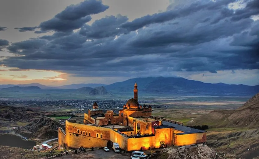
İshak Pasha Palace
It stands on the rocks of Old Doğubeyazıt, 8 km south-east of Doğubeyazıt. The inscription above the harem entrance of the palace reads:
"Bin yüz ile doksan dokuz oldu buna tarih,
İshaka meram üzere kem kıl dü cihanı"
(Its date is one thousand one hundred and ninety-nine; grant İshak his wish in both worlds.)
From this it is understood that the building was built in AH 1199 (AD 1784). The İshak named in the inscription is İshak Pasha II. The building was completed over a period of about a hundred years. Building began under Çolak Abdi Pasha, who was sanjak bey of Beyazıt between 1634 and 1680, and was completed in 1784 under İshak Pasha II.

In the palace, which consists of two courtyards and the sections built around them, the buildings are arranged in a "U" shape. The monumental portal leading into the first courtyard projects outwards. It is strengthened on each side by six round columns. Its face is set in a round-arched niche with a muqarnas hood. The main entrance has a depressed arch. The portal is decorated with relief plant motifs, stylised trees, muqarnas-like ornament and arches. The first courtyard contains the guardroom, a fountain, the guards' quarters, a dungeon, and places for harness and carriages.
The middle courtyard is rectangular and surrounded on all four sides by buildings. This part contains the servants' rooms, the selamlık (men's quarters), the mosque and the tomb.
The prayer hall of the rectangular mosque is square and covered by a dome on squinches with a high drum. In front of it is an enclosed porch with a terrace on top. Inside, the mosque has decoration reminiscent of the Empire style.
The tomb of Çolak Abdi Pasha, south of the mosque, was built on two storeys in the Seljuk manner.
A door from the middle courtyard leads into the rectangular harem apartments. This section also has a bath, a cellar, a kitchen and toilets.
In short, İshak Pasha Palace was built with a mix of styles and decoration, and stands out as a showy building reminiscent of medieval castles.
Anzavur Tepe
It lies 2 km north-west of the centre of Patnos. It is also known as Patnos Castle. It is an ancient Urartian city. Remains of a palace, a temple and buildings have been identified. The castle was built under King Menua and Argishti I, and the temple under Ishpuini. Of the badly damaged city, only the remains of the temple, the castle and some buildings survive.
Girik Tepe
It lies 1 km south-east of Patnos. It is also known as Değirmentepe. This Urartian city was founded under King Menua and his son Argishti I. Excavations between 1960 and 1963 uncovered a burnt inner courtyard, a throne room, halls, a cellar and a kitchen. Many rings, earrings, bracelets, belts, seals and ornaments of gold and bronze were also found here.
Churches of Ağrı
Üçkilise
Today this is the village of Taşteker, 18 km east of Taşlıçay. Üçkilise, which is mentioned in many sources, has been sacred since before Christ. The Arsacid Turks built a sun temple called Bagavan here. Later the Armenians built a monastery. However, it and the other historic remains have been destroyed. The monastery built by the Armenians was taken down in 1950, and its stones were used to build the Ağrı Central Mosque. There is also a belief that the Prophet Noah's grave is here.
Karagöz Church
It is near the village of Dayapınarı (Noktulu), 26 km west of Tutak. The church was carved into the rock underground. You go down to the church by stairs. A similar church is found in the village of Beklemez in Hamur.
Mosques of Ağrı
Doğubeyazıt Old Mosque
It is east of Doğubeyazıt, at the southern foot of the castle. The mosque was probably built by Yavuz Sultan Selim. The repair inscription above its portal shows that it was repaired in AH 1096 (AD 1687). It is a square, single-domed mosque. The prayer hall is covered by a dome 11.50 m in diameter. The five-bay porch has collapsed. The mosque has no decoration and is built with stones of different colours laid in a mixed pattern.
Toprakkale Mosque
It is in the village of the same name. The inscription on the mosque shows that it was built in 1684 by Mirza bin Abdi Pasha. The mosque is square with a single dome. Measuring 12.50 × 12.50 m, it is covered by a dome 8.20 m in diameter on squinches. Part of the porch, which rests on 14 wooden posts, was added later. There are 6 windows in the walls and 4 windows, set at alternate positions, in the dome drum.
The corners of the walls, the portal and the window surrounds are of cut stone, and the other parts are of rubble stone.
Hamur Kümbeti (tomb)
It is in the centre of Hamur. The inscription above the entrance shows only that it was built in 1802. In plan it resembles the Aşık Pasha Tomb in Kırşehir and differs from Seljuk and Ottoman tombs. The building is rectangular, with a mirror vault inside and a ridged roof outside. It is entered through a wooden door, not original, on the south side. It has 3 windows on the east face and 2 on the west. The building is of cut stone and gains a colourful look from four courses of basalt running round its faces. The tomb holds the graves of İbrahim Pasha, a grandson of İshak Pasha, and his family. The gravestones were decorated with plant motifs, eight-pointed stars and Arabic inscriptions, but these have been damaged.
Natural beauty of Ağrı
Diyadin hot springs
They lie 5 km south of the centre of Diyadin. The Diyadin hot springs are divided into three: Yılanlı, Davud and Köprü. Ziyaeddin Bey, son of the Akkoyunlu lord Uzun Hasan, built the first facilities around these springs, which had been in use for thousands of years.
The Davut and Köprü springs have similar water. The Köprü (bridge) spring takes its name from the natural bridge its deposits have formed over the Murat River. Rich in iron, sulphur, sulphate, calcium and bicarbonate, these springs are good for rheumatism, skin diseases and nephritis. The water is 60–70 °C.
The spa facilities consist of a pool, a bathhouse with private baths and a hydrology unit. As well as tourist hotels with a total of 150 beds, tents are also used.
With the Murat River and the Kudret Bridge around them making a lovely view, the Diyadin hot springs are a very popular place in summer.
Dambat hot spring
It is on the bank of the Murat River in the village of Yolluyazı (Dambat), 5 km from Ağrı. It is good for skin diseases and rheumatism.
Balık Gölü (Fish Lake)
It is on the Sinek plateau of Doğubeyazıt. At 2,241 m it is the highest lake in Türkiye. Its area is 34 km². Trout and carp are plentiful. It is 40 km from Taşlıçay. You can tour it by rowing boat.
It is a lava-dammed lake 18 km north-east of Taşlıçay, famous for its trout. The tree-lined shore of the lake is the area's place to relax. Its water is fresh. In the middle of the lake there is a small island of 4 decares with historic remains on it.
Meteor crater
It lies 35 km east of Doğubeyazıt and 2 km from the Iranian border, between the Gürbulak border gate and the village of Sarı Çavuş (Gürveren). It is the world's widest meteorite crater after the one in Alaska. The meteor crater was formed by a meteorite that fell in 1913. It is 35 m wide and 60 m deep. The meteorite buried in the ground is covered by a layer of soil.
Ice Cave
It lies at the southern foot of Little Ağrı, 3 km from the village of Hallaç. The cave, a natural monument, is an ellipse 8 m deep, 100 m long and 50 m wide. Inside the cave are basalt lavas, rocks and many ice stalagmites ranging from the size of a cactus to the size of a person. In the light these ice stalagmites shimmer in many colours. The cave is warm in winter and as cold as a refrigerator in summer. Warm and cold air currents blow constantly from the mouth of the cave.
The trace of Noah's Ark
A natural monument 3.5 km from the Türkiye–Iran transit road, south of Mount Ağrı between the villages of Telçeker and Meşar. The monument has the silhouette of a ship.
In 1987, by decision no. 3657, the Ministry of Culture and Tourism protected the site as a natural site and open-air museum, giving the ship-shaped mass the status of an immovable cultural property to be protected. A cafeteria with tourist facilities has been built at a spot with a bird's-eye view of the remains of the ship.
Culture and arts in Ağrı
Dress in Ağrı
MEN'S DRESS: men's dress follows fashionable and classic clothing. Apart from working hours in the village and hot days, every man goes about in a jacket and trousers. Middle-aged and older men wear long underpants (tuman) and a vest underneath. On cold days pyjamas are added too. Trousers, a work shirt and a jumper go over these. A jacket is never worn straight over a shirt; there is always a waistcoat or jumper in between. A hat on the head completes the outfit. Older men prefer to wear a fez or papak (fleece hat) instead of a hat.
Men always grow a moustache. In autumn and winter many wear papaks, socks, gloves and jumpers knitted from wool and mohair. A sako (overcoat) is worn on top. Men's accessories are a mohair scarf, an armband, a pamayıl, a tobacco case, mohair or wool gloves, and prayer beads.
WOMEN'S DRESS: in the villages women's clothing is more traditional and local. The entari (long dress) dominates women's dress. Women and girls do not dress carelessly or revealingly. At the bottom go the can gömleği (undershirt) and inner tuman. Wearing several entaris one on top of the other comes from old habit and the climate. A cardigan or jumper goes over the entaris. At work an apron is tied at the front and oversleeves are put on the arms. Care is taken that the top entari is of velvet, silk or silver thread. Silver and other belts are tied over it. On the feet are socks and a tuman reaching below the knee. Young girls and brides tie a scarf on their heads, middle-aged women a leçek, and older women cover their heads with a white cloth (cuna) tied over with a coloured printed scarf (heyrat). When women go out of the house or somewhere else, they cover their heads with a shawl or çar (wrap).
For everyday and special dress some women and girls wear a kofi (headdress) and hang gold at their necks. Women do not adorn themselves much day to day. Adornment is for weddings, religious holidays, going into town or somewhere else, and special days. Henna on women's hands and hair completes a woman's beauty. Blue and many-coloured beads worn on the neck and wrists are for adornment. Şeve, sırğa, hızıma, hakgığ, kohl, gold and bracelets, beauty spots, blue beads, rings, earrings and henna are among women's ornaments and jewellery.
Traditional dances of Ağrı province
Ağrı Sallaması:
The dance most often danced at village weddings. It is accompanied by davul and zurna (drum and shawm). Its figures are simple, so everyone can dance it easily. The dance has no fixed length.
Basso (Besra):
Danced to davul and zurna. The dance is thought to come from movements praising the talents of a beautiful girl called Besra. Girls and boys dance it together, with at least 4 people.
Laççi:
A girls' halay (line dance) in two parts, slow and fast, danced by 6 people. The figures are said to portray a gazelle. It is accompanied by davul and zurna.
Zeyno:
A girls' dance of medium pace, danced by at least 6 people to davul and zurna. It goes back to the 19th century.
Çep:
A slow, welcoming girls' halay danced by 6 people to davul and zurna. It is danced around Taşlıçay, Diyadin and Doğubeyazıt.
Koffi:
A girls' dance of medium pace danced by 6 people to davul and zurna.
Sarma:
A girls' halay danced around Tutak and Patnos by at least 6 people to davul and zurna.
Hessike:
Danced by men and women together to the tulum (bagpipe) and davul and zurna, this dance has a slow part and a hopping part.
Çimen-i Çiçek:
A dance with words, danced by at least 6 girls, with a slow part and a hopping part. The instruments are davul and zurna, sometimes the accordion.
Meyriko:
A dance danced by women. The lead dancer performs some figures alone to the music while the others clap to spur her on. Then everyone joins in.
Çoban Eli:
Danced by two people with sticks in their hands, this dance has a slow part and a hopping part. The dancers use the sticks like swords. It is danced around Doğubeyazıt, Cumaçay and Diyadin.
Ömer Ağa:
A dance for 6 men to davul and zurna. It has a yeldirme part and a hopping part. It is also danced in Zedikan, Eleşkirt, Toprakkale and Kösedağ.
Ağrı Gülüm:
A fast dance for six men. It is accompanied by davul and zurna, sometimes the clarinet. It is common around Doğubeyazıt, Diyadin and Aladağ. Apart from these there are halays such as Tıllara, Dümme, Gelin Gel Bara, Nuray, Köylü Kızı, Hene, Nare, Daldala and Lurke.
Serhat Barı:
A bar (group dance) danced by men. The dancers stand very close together, shoulders touching, arms around each other's waists or hands joined low. This dance, common around Tutak and Hamur and danced to davul and zurna, has figures of bravery and manliness.
Koçaklama Barı:
A men's bar that starts slowly and gradually speeds up. It is danced by 6 people to davul and zurna.
Yüksel Barı:
A fast men's bar danced by six people.
Sürgün Barı:
A men's dance that moves from slow to fast and is marked by varied footwork. It is danced around Doğubeyazıt and Patnos.
Ata Barı:
A fast dance danced by six people.
Ülker Barı:
A women's bar. It is danced by six people. It has a slow part and a yellenme part. Among the folk dances of Ağrı, the Köse Gelin play, a kind of village theatre, has a special place. A fine example of Anatolian folk spectacle, the Köse Gelin play is the most widespread of the village plays that enliven social life in the countryside.
Handicrafts of Ağrı
a) Carpet and kilim weaving:
Because winters in Ağrı are hard, wool weaving is mostly done in these months on hand looms, following tradition. The local name for kilim is yemeni. Kilim and carpet weaving are the most important handicrafts in Ağrı. Carpets, cushions, saddlebags, wool socks and jumpers, and mohair gloves, socks and papaks are also among the crafts based on wool and knitting. In this province, where livestock farming is widespread and dominant, yarn from the wool of Morkaraman sheep goes through many processes before it is ready to be woven on home looms. The best yarn comes from these Karaman sheep. Apart from courses and carpet workshops, carpets and kilims in Ağrı are mostly woven on upright ground looms without a press.
b) Wool jumpers and wool socks:
Jumpers and socks knitted from the wool of native sheep have artistic value. Because they are made by hand and not on looms, they are very sturdy and decorated with beautiful motifs. Traditional carpet and kilim motifs are used at the toes of the socks. Other motifs are created through the knitting pattern. Gloves and papaks are also knitted from wool. White ones are more popular.
c) Mohair papaks and mohair socks:
Mohair combed from goats is turned into clothing through special processes. The mohair is washed, cleaned and then combed. It is spun into yarn with a spindle called a teşi. Mohair clothes are knitted with needles. After knitting they are softened by being pressed between hot loaves of bread. This is how mohair clothes are fluffed up and fringed. Jumpers, scarves and gloves are also made from mohair. Because mohair socks reach the knee, they are also called dizleme. Various carpet and kilim motifs are worked on the dizleme.
d) Üzerlik or nazarlık (charms against the evil eye):
The üzerlik, which people call üzerlik or nazarlık, is an ornament made by threading the seeds of the üzerlik plant (Syrian rue) on strings in geometric shapes, and it also carries cultural value as a belief. According to folk belief, after the amulet and the blue bead the üzerlik is the best protection against the evil eye. Where the plant does not grow, it is made from barley and corn kernels that are dyed, together with rose hips gathered once they redden. An evil-eye bead is attached. The üzerlik grown and made especially in Doğubayazıt is the main ornament on the walls of village rooms.
e) Items made from wheat and rye straw:
Ripe wheat stalks are cleaned of their ears, soaked and softened until they can be woven. The women and girls of Ağrı make bags, baskets, tea trays and children's hats from them. When they are dyed in lovely colours and decorated with motifs, they also attract tourists.
f) Felt making:
Felt making is another craft in Ağrı that grew out of livestock farming. Felts, usually made from lamb's wool, are obtained by passing the wool through carding combs and then compressing it with special methods and techniques. Patterns are made on the felts in coloured wool. Felts are floor coverings used by the people of Ağrı who live in the countryside and keep livestock. Villagers take the wool from their own sheep and lambs to the felt makers and have the felts they need made. Because felt keeps you warm, it matters more than carpets and kilims, especially to herders on the highland pastures. Felt is also used to make items such as shepherds' hoods and shepherds' cloaks (kepenek). Felt, an important necessity, and felt making are a commercial trade in the region.
History of Ağrı
When peoples from Central Asia entered Anatolia, Ağrı formed a passage, and so it was the stage of many civilisations. But because these civilisations saw Ağrı as a gateway, they were unable to build a deep-rooted civilisation here.
When the Hittites, who are thought to have ruled the region, lost their power, the Hurrians settled in the region between 1340 BC and 1200 BC. The Hurrians could not hold Ağrı, which was far from their royal centre at Urfa.
The most deep-rooted civilisation was that of the Urartians. Urartu began campaigns against the lands north and north-east of Lake Van under King Ishpuini (825–810 BC), and under King Menua (810–786 BC) these raids grew heavier. The castles built on the roads to the north and north-east show that the campaigns here were planned in advance. An Urartian inscription found on the slopes of Mount Ağrı, between the villages of Karakoyunlu and Taşburun, is clear proof of King Menua's rule in this region.
Around 712 BC the Cimmerians, who reached as far as the Kızılırmak, established rule in Ağrı, if only temporarily. With the fall of the Assyrian state the Medes (708–555 BC) began to expand, and as a result they added Ağrı and its surroundings to their lands.
After the fall of the Medes, the Persians lived in the region for about two centuries, until Alexander the Great defeated the Persian king Darius III in 331 BC and took Anatolia. Taking advantage of the vacuum left by Alexander's death, the Armenians and Georgians seized the region. They quickly settled around the Murat River and Doğubeyazıt. Later the Arsacids and the Artaxiad kingdom ruled Ağrı and its surroundings.
The region was conquered by Islamic armies in the time of Caliph Uthman. Ağrı remained under Abbasid control until 872 and then passed to Byzantium.
After the Battle of Malazgirt (Manzikert) in 1071, Turkish tribes began to arrive in the region. For nearly a century Ağrı was within the borders of the Sökmenli state. Between 1027 and 1225 the Atabegs of Ani, in 1239 the Genghisids, between 1256 and 1358 the Ilkhanids, and the Jalayirids ruled Ağrı. The Ilkhanids sometimes held their kurultai (assemblies) on Mount Ağrı and governed Anatolia and Iran from here. In 1393 the Mongol khan Timur the Lame took the Ağrı region. Between 1405 and 1468 Ağrı was part of the Karakoyunlu lands, and when the Karakoyunlu fell it passed to the Akkoyunlu. After the Battle of Çaldıran in 1514, Ağrı was added to Ottoman lands by Yavuz Sultan Selim.
The province's name, Şorbulak in the Ottoman period, was changed to Karakilise in the time of the Armenians. Under Kâzım Karabekir Pasha the name Karakilise was changed to Karaköse.
Because Mount Ararat and the land of Ararat, mentioned in the Torah in connection with Noah's Flood, are thought to be Ağrı and its surroundings, Westerners also call Ağrı Ararat. Mount Ağrı, Türkiye's highest mountain at 5,165 m, is also within the province.
Getting to Ağrı
Ağrı can be reached by air or by road. For those travelling by air, there are Ankara–Ağrı flights twice a week, on Tuesdays and Thursdays. For those in western Türkiye, the journey to Ağrı by road takes more than 18 hours.
Districts of Ağrı
- Ağrı (provincial centre)
- Diyadin
- Doğubayazıt
- Eleşkirt
- Hamur
- Patnos
- Taşlıçay
- Tutak
Economy of Ağrı
In Ağrı people mostly make their living from farming and livestock. The economy rests more on livestock and animal products than on crops. In Ağrı, where the flat land is more fertile, field farming and livestock have developed. Animals raised on the highland pastures and meadows, and the products made from them, play an important part in the province's trade. Beekeeping is also practised in villages near the town centre. Industry is not very developed.
The province's need for industrial products and manufactured goods is generally met from distant provinces. Industry is not at a level that adds to or greatly affects Türkiye's economic strength. Ağrı's contribution to the national economy in crops is also small. The industrial plants that have been set up serve livestock farming, the main livelihood. Some of the animal raw materials are processed in these industries.
The centre of trade is Ağrı. Because it is on the Iranian border and has the Gürbulak border gate, trade is more developed in Doğubeyazıt. The district centres are also trading centres. Trade in the villages involves live animals, animal and farm products, and everyday goods sold by peddlers and traders.
- Ağrı Sugar Factory
The factory, whose foundation stone was laid in 1976, opened in 1984. The Ağrı sugar factory is the largest factory built in Ağrı in the Republican period. It has made a big contribution to the provincial economy, to employment and to livestock farming.
- Meat plant
Opened in 1976, the plant plays an important role in buying and processing the sheep, goats and cattle raised in the province. About 30,000–40,000 sheep and 5,000–10,000 cattle are slaughtered each year.
- Doğubeyazıt Feed Factory
It was set up in 1978 by the General Directorate of the Feed Industry. It produces sheep, cattle and chicken feed to develop livestock farming in the region and to meet the need for animal protein. Its annual capacity is 16,000 tonnes. In 1997 it produced a total of 3,625 tonnes of feed.
- Livestock farming
Ağrı is an important livestock centre of Türkiye. Livestock is the province's most important livelihood, and the economy rests on the sale of animals and animal products. Because of the province's geography, with wide highland pastures and meadows and soil not very suitable for farming, livestock farming has become very widespread.
Raising cattle and, above all, sheep and goats, along with dairy products, are Ağrı province's main sources of income. The mountains are home to wild goats, brown and white bears, martens, foxes, wolves and hares. Mount Ağrı also has the viper, whose skin is valuable, and the province, especially its reed beds and lake shores, has game birds such as wild duck, wild geese, cranes and partridges.
A meat plant and a dairy factory have been set up in the province to process animals and animal products. The Doğubeyazıt Feed Factory and the Ağrı Sugar Factory are also industrial plants that support livestock farming.
Ağrı's biggest contribution to the national economy is live animal exports and animal products. Animal products are used as milk, yoghurt, cheese, lor (curd cheese), butter and meat, and the hides and wool are also used a great deal. Wool is used to make mattresses. Gloves, socks, hats, felt, kilims and carpets, items both for use and for display, are knitted and woven. Animal dung is dried and used as a fuel called tezek.
The nomadic life seen in the province is a result of livestock farming. When June comes, the nomads flock to the foothills of Mount Ağrı, Mount Süphan and Mount Tendürek and to the Aladağ, Sinek, Mergezer, Mergemir, Kılıç and Katavin highland pastures. These places come alive with herds of animals.
Source: https://www.diyadinnet.com/Bolgemiz-10&Bolge=a%C4%9Fr%C4%B1-ekonomi-bilgileri


Comments
Loading comments…