
Bingöl
- Eastern Anatolia Region
About Bingöl
Bingöl province, in the Upper Euphrates section of the Eastern Anatolia Region, lies between longitudes 38°27′ and 40°27′ east and latitudes 41°20′ and 39°54′ north.
Bingöl borders Muş to the east, Erzincan and Erzurum to the north, Tunceli and Elazığ to the west and Diyarbakır to the south. 22.82 per cent of Bingöl's area belongs to the central district. After the central district come Genç, Karlıova and Solhan, in that order. The districts with the lowest altitude are the provincial centre and the Genç district centre. The district with the highest altitude is Karlıova.
The main yaylas (highland pastures) in the province are the Bingöl Yayla and the Şerafettin Yaylas; in Genç the Çötele (Çotla) Yayla; in Karlıova the Hırhal and Çavreş Yaylas; in Kiğı the Kiğı Yayla and the Dağın Düzü Yaylas; and in Adaklı the Kârer Yayla.
Bingöl, in the upper Euphrates section of the Eastern Anatolia Region, is known for many legends about its name. The province, which has been under the rule of various civilisations through history, was formerly a sub-district (bucak) of the Palu district called “ÇEVLİK”, or in popular speech “ÇOLİG”. In 1872 it became a district called “ÇAPAKÇUR”, and in 1936 it was made a province (again under the same name, by Law no. 2885 published in Official Gazette no. 3197 of 04.01.1936). The provincial centre was known as “Çapakçur” until 1945. In 1945 it was given the name “BİNGÖL”, and has been known by this name ever since.
Bingöl's famous dishes and desserts
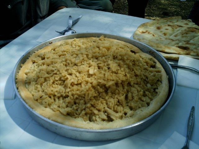
Gömme
A dough kneaded from just flour and water, without yeast, is shaped into a thick, round loaf and baked over embers; it is often made in winter.

Ayran çorbası
A soup cooked with yoghurt or ayran, wheat or rice, and dried mint.
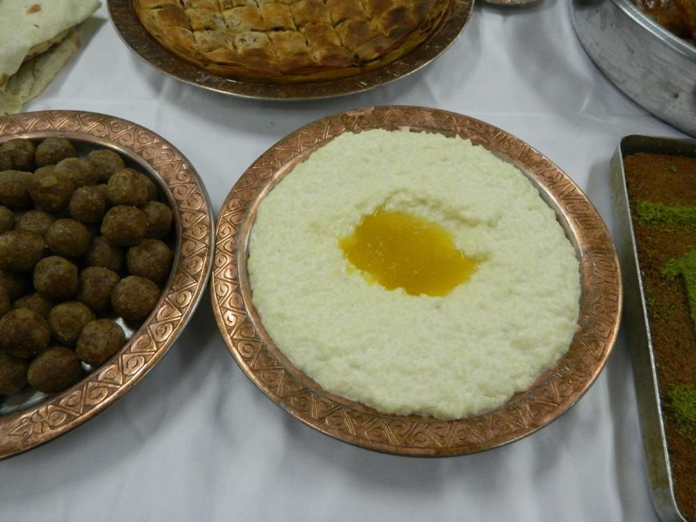
Mastuva
A dish cooked with yoghurt, wheat and butter, stirred until it reaches the right consistency; butter with mint and pepper is poured over it. It is served at iftar tables during Ramadan.
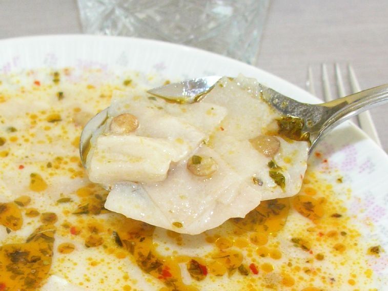
Tutmaç çorbası
Home-made dough cut into squares is cooked with lentils, and yoghurt and mint in butter are added.
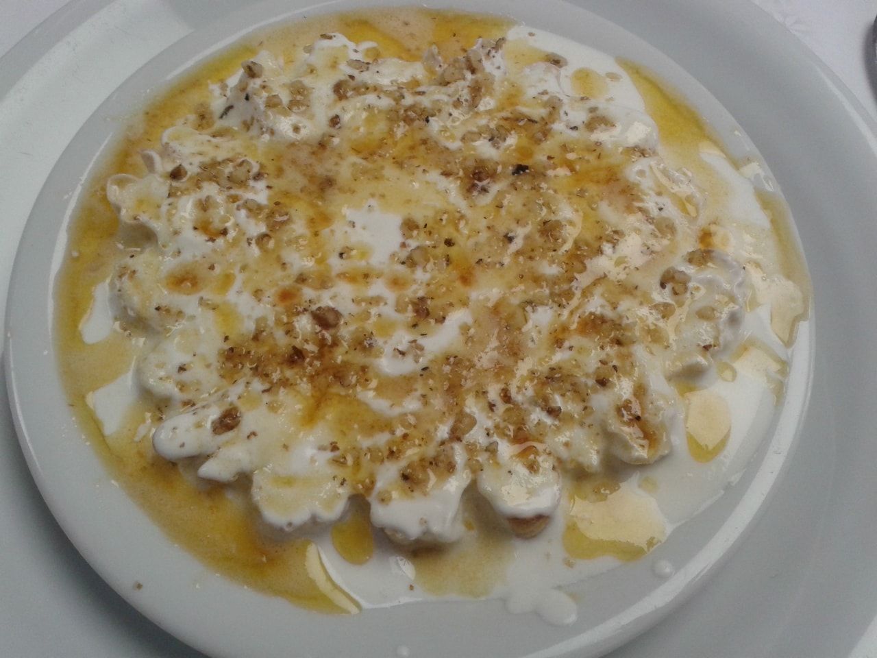
Sorina pel
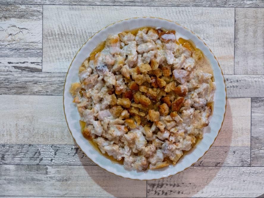
Keldoş


Places to visit in Bingöl
Floating Island
Floating island: islands with no connection to the land that float freely on the surface of the water. There are 22 known floating islands in Türkiye today. In the Aksakal Göl hamlet of Hazarşah village in the Solhan district of Bingöl province there are three islands that move. The floating island was discovered by the people who live in the area. The island displays a natural phenomenon not seen before. It is 4.5 km off the Bingöl–Solhan road. The access road is gravel and 1.5 km long. If the road is asphalted and the lake improved, it will attract more interest from Turkish and foreign tourists.
Çir Waterfall
Çir Waterfall: a beautiful waterfall on the stream that gives Uzundere village its name, passing through the middle of a 100 m high rock face called Çir taşı. The water makes a lovely sight as it falls 50 m into the rocky stream bed below.
Kral Kızı Castle
The castle, in the Genç district, was built on a hill where the Diyarbakır stream meets the Konsper stream. This place, called Keynekler, is in ruins. According to legend, the Persian King Dano had the castle built for his daughter.
Buban Chimneys
Vank Church
The Zağ Caves are at the 5th kilometre of the Gökçeli–Kuşburnu village road, which branches off to the right at the 18th kilometre of the Bingöl–Solhan–Muş highway. The Zağ Caves consist of caves/rooms spread over almost the whole front face of a natural rock mass that backs onto the mountain. These caves/rooms were made by human hands; inside they are connected by stepped passages and have several storeys. They date to the early 5th century AD, the Early Christian (Late Roman–Early Byzantine) period. The caves were probably used as a hidden settlement, living and worship space by Christian communities who were under pressure from the Roman Empire at that time.
Kiğı Castle
Kiğı Castle, south-east of the district centre, is a very solid structure. The castle, surrounded by steep rocks and very high, dominates the mountainous area. In appearance it recalls Urartian castles, and on its upper part are remains of architectural walls that can be dated to the Middle Ages.
Zağ Cave
The Zağ Caves are at the 5th kilometre of the Gökçeli–Kuşburnu village road, which branches off to the right at the 18th kilometre of the Bingöl–Solhan–Muş highway. The Zağ Caves consist of caves/rooms spread over almost the whole front face of a natural rock mass that backs onto the mountain. These caves/rooms were made by human hands; inside they are connected by stepped passages and have several storeys. They date to the early 5th century AD, the Early Christian (Late Roman–Early Byzantine) period. The caves were probably used as a hidden settlement, living and worship space by Christian communities who were under pressure from the Roman Empire at that time.
Ilıca Hot Springs and Thermal Facilities
The hot springs, in the Ilıcalar municipality attached to central Bingöl, are at the 20th kilometre of the Bingöl–Erzurum highway. Being on the highway gives the springs an important advantage for access. According to analyses, the pool water belongs to the group of bicarbonate, carbon-dioxide and naturally carbonated waters, and also contains anions such as chloride, sulphate and silicate and iron and aluminium cations. The Kös Hot Springs, which are therefore also notable for health tourism, receive on average 8,000 Turkish and 200 foreign visitors a year.
Source: https://www.gezilesiyer.com/bingolde-gezip-gorulecek-yerler.html
Culture and arts in Bingöl
Customs and traditions of Bingöl
Every society has its own customs and beliefs. In our area, the mores, customs, beliefs and folk medicine that have come down from the past and exist among the people are still respected, if only a little.
- A newborn child is not taken out of the house until its fortieth day has passed, and that house does not give fire to the neighbours.
- The call to prayer is recited into a newborn child's ear.
- If a crow (magpie) calls at the door, it brings bad luck.
- It is frowned upon for a newly arrived bride to speak with her father-in-law and brothers-in-law.
- Taking one's child on one's lap, attending to it and showing it affection in front of the elders of the family is not approved of.
- During solar and lunar eclipses the call to prayer is recited and two rak'ahs of prayer are performed.
- Nail clippings are buried in the earth.
- Dogs howling brings bad luck.
- On Fridays green wood is not cut and crops are not reaped.
- No food is cooked in a house of mourning for three days.
- If the cut umbilical cord of a newborn baby is placed in a mosque wall, the child will become a religious scholar; if it is placed in a school wall, the child will be educated.
- People who catch jaundice are given a yellow bead or gold to wear and dressed in yellow clothes.
- Laundry is not done on Fridays.
- A blue bead or amulet is worn for protection from the evil eye.
- To burst some boils and draw out the inflammation, an onion or a broad-leaved plant (the leaf called Pelhaves locally) is placed on them.
- If pear and apple trees blossom heavily, it will snow that year.
- If the sky is cloudy at night with redness in it, there will be no rain.
- If the clouds drift east the weather will be sunny; if they drift west there will be rain.
- If birds settle in flocks on the treetops, it is believed that winter will come early that year and be severe.
- Looking in a mirror at night brings bad luck.
- Sweeping the house in the evening drives away plenty.
- Water is poured out behind people setting off on a journey.
- Mud is rubbed on a bee sting, and a hot stone or iron is pressed on it.
- Cutting nails after sunset brings bad luck.
Handicrafts of Bingöl
Local handicrafts
Local handicrafts in Bingöl are based mainly on weaving and knitting. Because livestock is the people's most important resource in Bingöl and its area, its influence can be seen in the traditional handicrafts too. Besides weaving and knitting, crafts made from wood and clay are also widespread. Today, however, traditional handicrafts are slowly on the verge of disappearing with developing technology and urbanisation. When crafts made by the labour of human hands had to give way to machines, handicrafts lost their function. Even so, in Bingöl (especially in rural areas) local handicrafts can still be found. Weaving and knitting in particular, and pottery to a lesser extent, survive. In the town centres, carpet looms and courses have been set up and carpet-making continues within a plan. In rural areas, people traditionally produce, first of all to meet their own needs and with their own skill and artistic taste, carpets, kilims, palas (flat-woven rugs), socks, gloves, saddlebags, felt and pottery, as well as wooden spoons, dough troughs, rolling pins and kavals (shepherd's flutes). On the basis of our research and observations, especially in rural Bingöl, the most widely practised local handicrafts can be classified by the materials they are made from as follows.
Handicrafts made from animal products
It is known that most people in this area keep livestock and therefore make use of animal products. The main products made with the animals' wool for weaving and knitting are:
Carpets
In Bingöl carpet-making generally goes on in the autumn and winter months. Besides carpets produced on primitive looms, in recent years courses opened by the Public Education Centre have begun producing modern, high-quality carpets on modern looms. Hereke- and Isparta-type carpets in particular are woven in the Public Education courses. The quality of a carpet is judged by the type of wool used, the fineness and skill of the weaving, and the aesthetics of the patterns and dyeing. The dominant colour in Bingöl carpets is red. The motifs used in the carpets are mostly flowers, deveboynu (camel's neck), elibelinde (hands on hips), geometric shapes and other plant shapes. The wool used to make the carpet is cleaned thoroughly, made usable with spinning wheels and spindles, and then used in the weaving.
Kilims
The Bingöl kilims, produced by local people with the experience and skill of centuries, are dominated by an aesthetic sense and artistic taste drawn from the beauties of nature and riots of colour. Kilims use sunrises, pictures of animals, plant motifs and symmetrical or geometric patterns. The wool used to make a kilim is prepared in its natural colour or dyed with local dyes. Unlike a carpet, no knots are tied in weaving a kilim; the bobbin is passed between the warp threads and beaten down with a comb. The kilims are used as room decorations, bed covers and prayer rugs.
Saddlebags (heybe)
The heybe, generally used on the shoulder or on pack animals such as horses and donkeys to carry loads, consists of two bags joined together. Because they are made to carry goods and loads, they are woven very sturdily. In the area it is tied to the saddle behind the rider. The heybe is made from pieces of palas and kilim. The loom is simple, and it is woven on kilim and palas looms. The warp threads are of wool and goat hair. Its patterns are not very different from kilim and palas patterns.
Felt
It is made from white or red lamb's wool. Before making begins, the wool is sorted and washed. The wool, dried in the sun, is spread on a kilim. After spreading, it is rolled up together with the kilim. Once heated, the rolled wool is beaten on a flat surface by four strong men who roll it with their feet for a whole day without stopping. After the beating, the roll is opened and left to dry on a flat surface. The felt is spread in houses to sit on. Apart from this it is sewn into a rectangular shape and worn by shepherds on cold days.
Socks
They are usually made from sheep's wool. The socks use motifs that reflect the people's taste and artistic sense. Most socks are white, but they are also made from black and red wool. The motifs are shapes and symbols relating to plants, animals and objects. Sock-making starts with three needles. When the work reaches 4 cm, the number of needles is increased to five. Because winters in the area are harsh and long, sock-knitting is done in almost every house. Tassels can be added to the top of the socks if wanted.
Gloves
Gloves are knitted the same way as socks. They are knitted either with five fingers or with a single thumb. White and brown are generally used, and they can be plain or patterned. The patterns are usually flower shapes or other plant shapes. Tassels can be added to the fingertips and cuffs for decoration if wanted. Besides the weaving and knitting mentioned above, needlework by women and young girls is also very widespread in Bingöl. In particular, decoration embroidered on fabric with silver thread, and needle-lace edgings (oya) with flower motifs on the edges of headscarves, yemeni and laçık scarves, are other handicrafts often found in the area. Hand-made products based on lace, such as tablecloths and side-table covers, also stand out.
Handicrafts made from wood
Among the handicrafts based on woodwork, the most notable are these:
Dekik
Unique to Bingöl, the "dekik" is a kind of shepherd's instrument. The dekik, said to have been made in Bingöl since very early times, is made by hollowing out a round, ball-shaped piece of wood. It has two holes on its sides; one of them is covered with a cigarette paper and it is played by blowing. In this way it produces a harmonious sound. The dekik is still made especially in Çaytepe and the surrounding villages in the Genç district and in the villages of the Kiğı district.
Kaval
The kaval, a wind instrument used in Turkish folk music, is made in two forms, with and without a fipple. It is made of hornbeam and boxwood, and also of reed. It is widely used in the area especially as a shepherd's instrument (zel). Although it was often made by craftsmen in the province in the past, this craft too has gradually begun to decline today. As in many provinces of Anatolia, the kaval holds an important place in the imagination and artistic sense of the people of Bingöl. It features in many stories and legends. In the legend of "Kara Koyun" (the Black Sheep), the shepherd, to stop the black sheep, which has been fed plenty of salt and left without water for several days, from drinking, and so win the agha's beautiful daughter, skilfully takes up his kaval and achieves what everyone said was impossible. With his kaval and its emotional melodies, he moves the black sheep and stops it from drinking.
Spoons and ladles
Spoons and ladles are first roughly cut and then made from carved wood. Afterwards they are decorated and varnished. Over time, however, these decorated and varnished spoons give way to plain, unpatterned wooden spoons. The decorated ones are made rather for exhibition or as display items. In most villages in the area, wooden spoons and ladles are still made and keep their place among kitchen utensils. But with modernisation and industrialisation, wooden spoons and ladles are no longer produced by painstaking handwork as before and have slowly begun to lose their traditional character. Products such as metal spoons, forks and ladles have become widespread. Besides this woodwork, butter, honey and dough troughs and dowry chests peculiar to the area used to be made in Bingöl. These handicrafts were made especially before the Republic to meet people's needs. Among them, the dowry chests in particular were made with a very aesthetic appearance, thanks to the craftsmen's fine artistic sense and years of experience. Various patterns and carving motifs were worked on them and, if wanted, they were painted and made ready for use. Wooden carts, cradles and toys for children, and farming tools such as ploughs, threshing sledges and winnowing tools to meet the needs of farmers, are also among the handicrafts commonly made in the area. These hand-made products can still be found in rural settlements.
Handicrafts made from earth
Handicrafts made from earth are made from a special clay that can be used and easily kneaded and shaped. Various techniques are applied to the soft, workable earth to give it certain forms. Among the handicrafts made with this kind of material, the notable ones are jugs, jars, pans and pots of various sizes and shapes based on pottery, and bread tandırs made using earth and stone as material.
Tandır
Bread tandırs made of earth and stone to meet people's needs serve as a kind of oven. Bread baked in the tandır has a flavour all its own. These tandırs can still be found in town centres as well as in many rural areas. As in pottery, a special earth that kneads easily and takes shape is used for the tandır. This earth is kneaded and a little straw is mixed in to give it durability and stickiness. The kneaded clay is laid in coils one on top of another and fused into a bowl about 70–80 cm high. The bowl widens from its mouth towards its base, and at the bottom it has a small tunnel facing forwards. The tandır's ash is removed and the tandır cleaned through this little tunnel. The outside of the tandır bowl is walled with stones to protect its structure. When bread is to be baked, the tandır is heated with fuel such as wood and planks. The bread dough is moistened and stuck to the inside of the bowl of the tandır at a normal heat. In this way the bread bakes in the tandır bowl over the wood fire.
Folk dances of Bingöl
Bingöl folk dances have won great admiration with their distinctive character. They are imitated especially by neighbouring provinces. We see Bingöl folk dances being danced especially in Diyarbakır.
Kartal (Eagle) dance
In this dance the dancers resemble eagles flying over the hard rocks of the mountains. The dance is said to have emerged after the First World War. It tells of the heroic fight of our victorious forces in the battle between the Russian forces attacking from Karlıova towards Şeref Meydanı and our soldiers and militia. The eagle dance symbolises the eagles swooping on the enemy corpses left on the battlefield.
Delilo dance
The dance is danced by girls and boys together. It is one of the most danced dances in the area.
Meryemo: holding hands, the dancers form a circle. The joined hands swing in and out. Forward crouching movements are made. While the dance is performed, the following folk song is sung.
Çepik (hand-clapping)
It is a dance with very vigorous figures. The dance reflects the struggle of the local people with nature and a kind of trial of strength between the dancers. It is danced to the davul and zurna (drum and shawm). As the music begins, the dance starts with the right foot. Three steps are taken forward, and at the end of the three steps the hands are clapped. After these movements are repeated several times, the partners turn to each other and strike palms hard against each other three times. These striking movements are done several times.
Çaçan
It is a lively dance. It is one of the best-loved and most popular dances in the area. The rhythm is kept by stamping the feet on the ground, and three jumps are made forward. Care is taken that the movements are done at the same time. While the dance is performed, the following folk song is most often sung.
Other folk dances
- Gövend (Halay), Horani
- Spectator and entertainment games
- Sarımsak (Garlic) game
- Darı Sulama (Watering the Millet)
- Değirmenci (The Miller)
- Muhtar (The Village Headman)
- Kalaycı (The Tinsmith)
- Kalkağan festivity
- Çulapı (three-legged forked tree) game
- Gelin (Bride) game
- Cirit (javelin game)
- Şel Atmak (stone throwing)
History of Bingöl
History of Bingöl province
Bingöl, which has an ancient history, is one of our provinces in the Eastern Anatolia Region of Türkiye. It is one of our fine cities, which has hosted many civilisations in a history going back to the 2000s BC. After the Hittites, the Urartians and the Roman Empire, Bingöl met Islam. Then came the Akkoyunlu and the Ottomans, and after the proclamation of the Republic it took its present form.
Our province is one of the regions of Anatolia that never saw enemy invasion. Bingöl's history has been worked out mostly by studying the history of the neighbouring provinces. In ancient times the cities of Erzurum, Erzincan, Diyarbakır, Bitlis, Ahlat, Van and Tunceli were capitals of a beylik or ruler. Bingöl was kept mostly as pasture belonging to these beyliks. The fact that no remains of a city have been found within Bingöl province so far confirms this. In one of his works the historian Herodotus divided Anatolia into a number of regions and gave the name "KOMOJEN" (Commagene) to the area where today's Muş, Diyarbakır and Bingöl provinces lie. In the Ottoman period Bingöl was governed as part of the neighbouring provinces, but in the Republican period it became a province.

Bingöl in the Hittite and Hurrian period
The Hurrians came to the South-eastern Anatolia Region around 2000 BC and founded the city of "VASUK.ANI" (Washukanni) on the Euphrates, around Urfa and Mardin. They are the people who went down in history as the Mitanni State. The Mitanni, who established full sovereignty in Eastern Anatolia, had relations with the Hittites. It is thought that after the death of the Hittite King Telepinu the Hittites came under Mitanni protection. In the New Kingdom period the Hittites crossed the Taurus and began to press the Mitanni State; Šuppiluliuma made the Mitanni prince his son-in-law and took them under his protection. Around 1360 BC the areas around Harput, Bingöl and Muş passed into Hittite hands.
Bingöl in the Urartian period
With the fall of the Hittites around 1200 BC, the Urartians, who lived in the Van region, expanded westwards, taking Bitlis, Muş and Bingöl and advancing along the Murat valley. The Urartian King Menua had the Sebiterias, Bağın and Mazgirt castles built to protect the Bingöl yaylas. After 745 BC the Urartians were defeated in the war between the Assyrian King Tiglath-Pileser and the Urartian King Sardur III. The Medes, who founded their state in Iran, joined forces with the Babylonians. With the help of the Urartians too, they defeated the Assyrians and wiped them from history (612 BC). Around 550 BC Cyrus, of the Anshan tribe of Iran, defeated the Medes and founded the Persian State. Three years later he began raids to the west and took the areas around Bingöl, Elazığ and Tunceli.
In 546 BC he marched on Lydia. Defeating the Lydians too, he became master of all Anatolia. The Persians, defeated at the Battle of Gaugamela, lost the lands they held. Alexander's empire took possession of these lands. After Alexander's death the Seleucids seized the region. A Turkish ruler named Arsak fought both the Seleucids and the Sasanians to free the region but did not succeed. Between 200 and 189 BC the Komuk Turks revived. They founded the Kingdom of Commagene. They made today's Samsat district (Samaysat–Samosata), south-west of Mount Nemrut (in the Adıyaman area), their capital. Zariadres, advancing to the east, took the whole area called Sophene, namely Bingöl, Elazığ, Tunceli and their surroundings, and extended as far as Van.
Bingöl in the Roman period
The Kingdom of Armenia, founded in the upper Aras basin around 75 BC, began to make its presence felt around AD 50. When the Armenian King TIGRANES fell out with the Romans, the Roman general LUCULLUS marched on the Armenian kingdom; POMPEY crossed the Ergani pass and defeated the Armenian King TIGRANES, who had taken refuge in the fortress of TIGRANOCERTA at Diyarbakır. In this way he took the whole Sophene region. After the Roman general GUREGIO also took ARTAXATA, the capital of Armenia, and attached the Armenian kingdom to Rome, the Armenians were not able to assert themselves much from then on.

The spread of Islam to Bingöl
In the time of Caliph Umar, Syria and Iraq passed into Arab hands. Khalid ibn al-Walid, one of the Islamic commanders, took the castles of Arned (Diyarbakır), Maden and Palu. He also took Bingöl's Azakpert Castle and reached as far as the Erzincan region. After this, disturbances broke out here and there in Anatolia. While these disturbances continued, in 1040 the Oghuz tribes united and founded the Seljuk State. They organised themselves in a short time. Süleyman, son of Kutalmış, decided to set out on a campaign to free Anatolia from the Urartians. He first took Antalya and its surroundings. Çubuk Bey took the regions known as Commagene, Sophene and Hını Ziyad. In this way the Seljuks set out by various routes to conquer Anatolia. Tuğrul Bey took charge of the conquest of Anatolia. He advanced in three columns. Emir Dinar took Bingöl on his return from Malatya. When he reached the Muş and Sason area he was attacked by Byzantine soldiers and suffered heavy losses. Because winter set in, he returned to Ilenesan. When Alp Arslan became sultan he took Malazgirt (Manzikert). Later he took Muş, Bingöl, Silvan and Diyarbakır. When struggles for the throne and internal unrest began among the Seljuks, the Mongols attacked Anatolia. Baiju Noyan besieged Erzurum. Bingöl passed into Mongol hands.

Bingöl in the Safavid period
In the Akkoyunlu period, while Muş, Kiğı, Solhan and Pasinler were provincial centres, Genç was governed by minor officials. When Akkoyunlu rule came to an end in 1473, the Iranian ruler Shah Ismail began attacks on the east. He took the Bingöl region. Sultan Selim I (Yavuz) decided to campaign against Iran. The two armies met at Çaldıran. He defeated Shah Ismail at the Battle of Çaldıran. He entrusted the task of securing the unity of Eastern Anatolia to Vizier Bıyıklı Mehmet Pasha and the historian İdris of Bitlis.
Bingöl in the Ottoman period
In 1514 Sultan Selim I had brought the north of Bingöl, Erzincan, Tercan and Erzurum under Ottoman rule. Süleyman Bey, one of the beys of Çapakçur, accepted Ottoman sovereignty, and Çapakçur (Bingöl) passed to the Ottomans. "Çapakçur and its surroundings fell to Süleyman Bey, and the other castles to Ahmet Bey. These brothers, living under Ottoman protection, got on well at first, but later fell out. At Ahmet Bey's instigation the Sublime Porte accused Süleyman Bey, and Süleyman Bey was even executed in Çapakçur by a firman. After Süleyman Bey's execution his son Maksut Bey entered Ottoman service and, because he joined Süleyman the Magnificent on the Nakhchivan campaign and distinguished himself at the Arap stream, Süleyman granted Maksut Bey the castle of Çapakçur, inherited from his forefathers, as a hereditary holding (ocaklık)." (45) When Süleyman the Magnificent formed the eyalet of Diyarbakır, he attached Çapakçur to it as a sanjak. Bingöl held an important place for the Ottomans.
This is because Bingöl was used as a base in the Ottomans' struggles against Iran, and it was also economically important. "On 23 May 1554 Süleyman the Magnificent was in the Bingöl area. At a place called Hokhzik on the Göynük stream the Janissaries welcomed the Sultan with a great ceremony. In 1578 Çapakçur sent soldiers to Shirvan. It defended this city and castle against the Safavids. In the second half of the 19th century, after the eyalets were abolished, Çapakçur became the centre of the kaza (district) of the same name in the Genç sanjak of the vilayet of Bitlis. According to V. Cuinet, at the end of the 19th century Çapakçur was a small settlement of 450 households with 8 shops and a bakery, surrounded by orchards and vineyards, and its population was about 1,075. A coarse cloth called şayak was also produced here and sent to the surrounding places." (48) Seljuk period: in 1243, with the Seljuks' defeat at the Battle of Kösedağ, the Mongol invasion of Anatolia began and Bingöl was overrun by the Mongols. "In the face of the Mongol attack from the east, the Bereket and Sarıhan tribes of the Khwarazmians came to Cebellibereket and the Solhan tribe to the area of the same name. According to tradition, while the Khwarazmshah, whose army had scattered, was hiding in one of the nearby villages, a villager from outside saw the shah, approached him, said 'This is the man (the Khwarazmshah) who killed my brother at Ahlat', and killed him with his spear.
After this the Zazas made the place where the Shah lay into a shrine, and the village where the Solhan tribe lived came to be called Harzemşah village." (26) Bingöl province, in the Upper Euphrates section of the Eastern Anatolia Region, lies between longitudes 38°27′ and 40°27′ east and latitudes 41°20′ and 39°54′ north. Bingöl borders Muş to the east, Erzincan and Erzurum to the north, Tunceli and Elazığ to the west and Diyarbakır to the south. The area of Bingöl by district and the altitudes of the district centres above sea level are shown in Table 1. 22.82 per cent of Bingöl's area belongs to the central district. After the central district come Genç, Karlıova and Solhan, in that order. The districts with the lowest altitude are the provincial centre and the Genç district centre. The district with the highest altitude is Karlıova. The main yaylas in our province are the Bingöl Yayla and the Şerafettin Yaylas; in Genç the Çötele (Çotla) Yayla; in Karlıova the Hırhal and Çavreş Yaylas; in Kiğı the Kiğı Yayla and the Dağın Düzü Yaylas; and in Adaklı the Karer Yayla. These yaylas, which are also very well suited to livestock, are indispensable for the Beritan (Bertyan) tribe and the surrounding villages. The honey from beekeeping on these yaylas is now sought after all over the country. When the First World War began, the Ottoman State entered the war too. In 1915 the Russians went on the offensive and advanced as far as Eleşkirt, Malazgirt and Pasinler.
At this, the people began to migrate across the Bingöl mountains towards Varto and Karlıova. The Armenians fled the Turkish Army and went over to the Russian Army. The Russians entered Erzurum on 16 February 1916. At this, under the leadership of Küçük Ağa of Karer, the National Forces began to take up positions on the Karer Mountains, the Sığı Gorge and Eşek Meydanı (later Şeref Meydanı). Two of our divisions that reached Çapakçur also joined these National Forces. Towards the end of March the Russians began to attack these fronts. After 15 days of fighting they suffered heavy losses and began to flee towards the Şerafettin and Çafreş mountains. On 15 May 1916 the Russians attacked again on all fronts from Şeref Meydanı to Erzincan. But by this time the Turkish Army returning from the victory at Çanakkale (Gallipoli) had begun to mass on the Russian front. This army was commanded by Ahmet İzzet Pasha. He set up his headquarters in Gazik (Kuruca) village of Çapakçur. Faik Pasha, commanding the 2nd Corps, set up his headquarters in Simsor village of the Sancak sub-district. The army units took up positions on Karer Mountain and Şeref Meydanı. On 5 June 1916 the Russians attacked on many fronts. But they had no success in this offensive either. Leaving many dead behind, they began to withdraw. On 8 June 1916 the Russians attacked the Çapakçur front. The Muğla detachments resisted them. On 9 June the Russian cavalry, reinforced with two infantry battalions, forced the Oğnut detachments to withdraw towards Sığı. On 11 June they attacked the Masla stream. The Buğlan detachments began to hold the ridges stretching towards Melekhan. On 13 June the Russians, attacking the Oğnut detachment at the Masalla (Balıklı Çay) stream and the Sığı gorge, achieved nothing. On 26 June the 3rd Corps crossed to the western part of the Masalla stream. It drove the Russians north-west of Sazani to the east of the Masalla stream. At the beginning of July the Russians attacked again.
In this offensive our units were seen to fall back. On 9 July some units of the 7th Division and militia forces were sent here. On 12 July 1916 the Russians attacked from the Muş front. After very bloody fighting the Russians began to withdraw with heavy losses. On the night of 13–14 July the 8th Division's front was broken by a night raid by the 261st Regiment of the 66th Division. The division withdrew to the Şen position. The Russians pursued the 8th Division and continued their attacks. The 8th Division withdrew to its positions in Malam village. On 25 July 1916 Erzincan fell into Russian hands. On 27 July light Russian forces attacked towards Celigöl hill and Oğnut but were driven back. On 29 July they attacked Celigöl hill again. But this attack was stopped, with nearly a thousand Russian soldiers killed. On 1 August the Russians launched a new attack on Celigöl hill with far superior forces. The Russian forces, though supported by artillery fire, could not hold here either and were forced to withdraw to the Arçük and Karer mountain line. The Russians could not hold out against the Turkish forces that attacked on 3 and 6 August. The Russian forces under Nazarbekov withdrew to the southern positions of Bitlis. On 6 August Muş was cleared of Russian forces. In this way the Russians were driven in disarray to the north of the Murat valley. Also on 8 August the 7th Division had reached Buğlan, the 53rd Division the Melikan yayla, the 14th Division Celigöl hill, and the 1st Division the Halifan–Çatak line and the Azakpert and Termen lines.
The Russian forces attacked with a force of seven battalions on 17 and 19 August 1919 but again achieved nothing. On 20 August they attacked the left flank of the 7th Division with large forces. The 1st Corps withdrew to its positions on the Masalla stream. On 22 August the Russians began to fortify the ground they had won. On 23 August they attacked Bitlis and Muş. On the evening of 28 August there was fierce fighting. On 29 August the forces of the 16th and 3rd Corps counter-attacked and drove the enemy back. They took the east and north-west of Melikhan village. Corps commander Faik Pasha was killed while following the operation from the 47th Division's observation post. The 2nd Corps broke the enemy attack and counter-attacked; on 31 August, while the army commander was resting the units, the Russians seized the opportunity to attack the 16th Corps and drove it behind the Masalla stream. On 9 September the Russians, wanting to take Kara-Baba hill, attacked. Taking our positions at Demlek and the Tümük plain, they reached the north of Karababa. But with the attack of the 34th Regiment the Russians were forced to withdraw completely. On 7 December 1917, after the revolution in Russia, an armistice was signed with the Russians at Erzincan, and the Russians left our eastern provinces.
Bingöl in the Republican period
After the proclamation of the Republic, Bingöl, attached to Elazığ in 1926 and to Muş in 1929, became a province in 1936. In 1945 the name of the provincial centre, Çapakçur, was changed to Bingöl. The land within the provincial borders is very rugged and high. Its average altitude above sea level exceeds 1,250 metres. Mountains cover a very large area. The Bingöl mountains are generally made of basalt and andesite. This volcanic mass has covered the sedimentary layers beneath. The volcanic masses are therefore younger than the sedimentary ones. The Bingöl mountains run north-west to south-east; their northern slopes are gently sloping, while the southern parts are very steep.

The presence of hot springs on the southern slope makes it clear that this slope was steepened by a fault line, and therefore that a stream runs through here. When Türkiye's earthquake zones are examined, it can be seen that distinct fault lines running north-east to south-west pass through the area where our province lies. Fault lines running in various directions are found in the region. Since it is observed that the fault lines are hidden beneath the sedimentary layers without creating different surface levels, come to the surface here and there, and that hot springs emerge from these places, the view forms that faint fault lines could be anywhere in the region.
Where does the name of Bingöl province come from?
Bingöl, in the upper Euphrates section of the Eastern Anatolia Region, is known for many legends about its name. The province, which has been under the rule of various civilisations through history, was formerly a sub-district (bucak) of the Palu district called "ÇEVLİK", or in popular speech "ÇOLİG". In 1872 it became a district called "ÇAPAKÇUR", and in 1936 it was made a province (again under the same name, by Law no. 2885 published in Official Gazette no. 3197 of 04.01.1936). The provincial centre was known as "Çapakçur" until 1945. In 1945 it was given the name "BİNGÖL", and has been known by this name ever since. The province's old name, "ÇEVLİK", means in Anatolian dialects a place with vineyards and gardens beside a stream. Indeed Çevlik, the old settlement area of Bingöl, was founded on a green plain of vineyards and gardens beside the Çapakçur stream, and fits its name. The word "ÇEVLİK" still survives in popular speech as "ÇOLİG".

Today many people use the name "Çolig" alongside the name Bingöl. Especially in rural areas, the provincial centre is known by this name. "The name of the place founded on the site of today's Bingöl, and known until 1945 as Çapakçur, is first found in medieval Islamic sources in the form Cebelü Cur (Yakut, II, 102)." It is not known exactly since when the name Çapakçur has been used. However, Evliya Çelebi, in his Seyahatname (Book of Travels), states on the basis of tradition that Çapakçur was founded by Alexander the Great and that he gave it this name. The Seyahatname tells how Alexander the Great, who consulted many doctors to find a cure for his pains and to rid himself of the two horns on his head but could find no remedy, finally set out to search for the water of life. Alexander, after much effort to find the water of life, finally drank from a spring fed by it, if not the source itself, and was freed of his pains and his horns; he gave the water that had helped him the name Çapakçur, which means "Water of Paradise" in the "Makdis language". He called his physician Filkos to him and said: "You have struggled with me for so long and have not been able to find a remedy for my pain.
God Almighty has given its remedy from the rivers of Paradise. Build a castle for me here and name it 'Çapakçur'. On this order, Çapakçur Castle was built on the bank of the Murat River in 315 days…" From then until 1945, Çapakçur was used as the name of the provincial centre. In 1945 it was given the name Bingöl. Bingöl took its name from the mountain of that name. The mountain, in turn, takes its name from the hundreds, perhaps thousands, of glacial lakes large and small upon it. So the glacial lakes on the snowy mountain, whose summit is wrapped in patches of mist and milk-white, became immortal in its heart by giving their name to a city and a province.
Of the many legends about the name Bingöl, these two are the best known.
1. Evliya Çelebi tells it this way in his Seyahatname: "A hunter shot a bird, and while he was cleaning it at the lake, the bird came back to life, dived into the lake and disappeared. It came to light that the lake was a source of the water of life. When this secret came out, by God's command it was split into a thousand pieces, and it became impossible to know which one was the source of the water of life."
2. "In one of two armies fighting in this region, a water shortage began. One detachment went up into the mountains to find water. They did find good water and drank it. But so that it could be found easily next time, they put a cloth marker beside the water. After the soldiers returned to their unit, another detachment began to climb the mountains to drink water. Their commander climbed a hill and, seeing hundreds of lakes at once, expressed his amazement like this: this is not one lake, it is a thousand lakes (bin göl). And so the city in the region where that battle was fought came to be called 'BİNGÖL'. This and similar accounts are how the name Bingöl is known.
Getting to Bingöl
By road
Bingöl can be reached by road from anywhere in Türkiye, and the bus station is in the city centre.
By rail
From the station in the Genç district, rail travel is possible east to Tatvan and west, via Elazığ, as far as Istanbul.
By air
The nearest airport to the city is in Muş province (118 km), with direct flights from Ankara except on Saturdays and Sundays.
Districts of Bingöl
- Bingöl (provincial centre)
- Adaklı
- Genç
- Karlıova
- Kiğı
- Solhan
- Yayladere
- Yedisu
Economy of Bingöl
Livestock
Cattle, sheep and goats
53 per cent of the area of Bingöl province is meadow and pasture. This makes our province extremely well suited to livestock. In recent years livestock farming declined because of conditions in the region. But with the end of terrorist incidents, the livestock sector has begun to revive. As of 2000, 112 of our 160 yaylas had been opened for use. By number this corresponds to 70 per cent, and by area to 86 per cent.
Flocks grazed in summer especially on the Erzurum and Karlıova yaylas are taken towards winter to our southern provinces such as Diyarbakır and Şanlıurfa. In spring this movement is reversed.
Beekeeping
The beekeeping breeding station was established on 10 October 1978 under the name "Breeding Station Directorate". Until 1980 it carried on beekeeping, egg-laying poultry and rabbit breeding. In 1980 all the hives with bees died because of harsh winter conditions. Later rabbit breeding was also stopped. In 1984 the poultry unit was also closed. A turkey branch was set up and production of turkey poults began. In 1986 it became an institution attached to the Ministry's Provincial Directorate. The name of the institution was changed to "Beekeeping Breeding Station Directorate", and it still continues beekeeping and turkey breeding.
Forestry
Bingöl, ideally suited to forestry in terms of climate and terrain, is one of the provinces of the Eastern Anatolia Region richest in forest. However, the long-standing use of the forests to meet fuel needs and for livestock has turned them into degraded coppice. Table 41 shows the distribution of forest areas in the province by management unit.
Mining
The mineral reserves of any importance in Bingöl, which is not described as a province rich in underground resources, are the iron deposits in the Genç district and the lignite deposits in the Karlıova district. Surveys of the iron ore in the Avnik field in the Genç district began in 1935 and were intensified after 1975.
Trade
The trade of Bingöl province consists of animal products such as butter, goat hair, raw hides and game skins, and the buying and selling of all kinds of livestock. Walnuts, tragacanth gum and çiriş (asphodel glue) can also be counted among the main trade goods. Every year slaughter animals such as sheep, goats and cattle are sent in flocks from Bingöl to large centres such as Elazığ, Diyarbakır, Urfa and Gaziantep. Fleece and hair are generally sent unshorn on the animals, but some are sent shorn. In the past animals were also exported from these areas to Syria. A large part of the butter known in the market as Urfa butter is butter obtained from various parts of Bingöl province.
In the past these were collected in Urfa and then stockpiled in large centres under this name. Traders in this business learned that the really fine butter was collected from here. The agents of big traders go as far as the yaylas and villages to collect butter and send it to Elazığ and other centres. Game and animal skins and honey are shipped mostly to Erzurum, goods such as tragacanth and çiriş to Istanbul, and walnuts especially to Elazığ. Weaving is a separate line of work done specially by housewives. 80 per cent of the people use their own weavings. The men wear clothes made from cloth as thick as broadcloth, woven from lamb's wool on hand looms, while the women generally weave brown cotton cloth for themselves. The city's need for firewood and timber is met from the surrounding oak woods, and flour is produced in mills that use the current of the Bingöl stream. A market is set up on the edge of the city every Friday, where all kinds of goods are traded. Bingöl butter in particular is the market's leading product. Among the livestock and animal products sold mainly to Elazığ, and to Diyarbakır, Gaziantep, Urfa and Adana, Bingöl butter has a very high commercial value. Bingöl sends its butter via these provinces to Istanbul and Ankara and buys the goods it needs from there.
Industrial infrastructure
In terms of the Organised Industrial Zone and Small Industrial Estates, which serve to spread industry, gather industrial plants that may be set up into a planned settlement pattern, solve the repair and maintenance problems of medium and large industry, produce certain goods requiring special skills and support industrial businesses as suppliers, and which are especially important for industrial infrastructure, Bingöl province is not yet at the desired level. A Small Industrial Estate with a capacity of 154 workplaces operates in the provincial centre.
On this estate there are 154 workplaces in 13 trades in total: 12 sawmills, 8 furniture makers, 4 tyre shops, 4 battery shops, 8 auto electricians, 26 car repairers, 5 lathe shops, 36 carpenters, 10 car upholsterers, 10 car painters, 5 body shops, 20 welders and 6 blacksmiths. The estate also has 1 coffee house, 3 ironmongers, 2 furniture shops, 2 grocers, 1 post office, 2 hardware stores, 7 car parts sellers and 1 restaurant, and employs 700 people in total. In 1990 it was decided to set up an Organised Industrial Zone in the provincial centre. The Organised Industrial Zone was included in the investment programme in 1991. Survey and engineering services were tendered in 1995. The firm concerned prepared the project for the survey and engineering services and delivered it to the founding committee in 1996. The infrastructure construction of the Organised Industrial Zone was tendered on 25 March 1997. The site was handed over to the firm on 30 April 1997, and the firm actually began construction.
Manufacturing industry
According to the results of the 1975 General Population Census, the number of people employed in manufacturing was 992. This figure reached 1,175 in 1980. It fell to 895 in 1985 and rose to 1,936 in 1990. In 1990, while the share of the workforce employed in manufacturing was 11.9 per cent in Türkiye and 3.49 per cent in the Eastern Anatolia Region, only 1.8 per cent of the working population in Bingöl was employed in it. The picture is no different when it comes to manufacturing's share of gross domestic product and its growth rate. In 1997, at current prices, manufacturing's share of GDP was 21.6 per cent in Türkiye, with a growth rate of 99.1 per cent; in the Eastern Anatolia Region it was 9.4 per cent with a growth rate of 23.2 per cent, while in Bingöl these figures were 8.4 per cent and 5.3 per cent respectively.


Comments
Loading comments…