
Iğdır
- Eastern Anatolia Region
About Iğdır
Iğdır, on Türkiye's eastern border, is a province worth seeing for the legendary Mount Ağrı (Ararat).
Iğdır is on Türkiye's eastern border, in a region largely made up of high plateaus and mountains. Yet thanks to its geology and climate, the Iğdır Plain has soils suited to every kind of farming, including fruit and cotton. Most of Mount Ağrı (Ararat), Türkiye's highest mountain, lies within the province's borders. There are many legends about Mount Ağrı, the best known being Noah's Ark. It is widely believed that after the flood, mentioned in holy books such as the Bible, the Torah and the Qur'an and also in the famous Sumerian epic of “Gilgamesh”, Noah's Ark came to rest on Mount Ağrı. Another tale is the legend of Mount Ağrı, which grew out of the folk belief that the mountain rages against cruelty and evil.
According to archaeological research, the province's history goes back to the Paleolithic. The area was also settled in the Mesolithic, Chalcolithic and Early Bronze ages; in the 1st millennium BC the Urartians, Assyrians and Cimmerian and Scythian raids were influential. The region then came under Persian, Macedonian, Seleucid and Roman rule and passed to the Arabs in the 7th century AD. A constant subject of conflict between the Arabs and the Eastern Roman Empire, and changing hands many times, the area came under the Seljuks in 1064. Iğdır suffered the Mongol invasion in the 13th century, joined the Ottoman lands with the victory at Chaldiran in 1514, and was under Iranian occupation in 1737–1746 and Russian occupation between 1878 and 1918.
The Silk Road, coming from Iran and running via Doğubayazıt, Kars, Erzurum and Erzincan into Central Anatolia, passes through Iğdır.
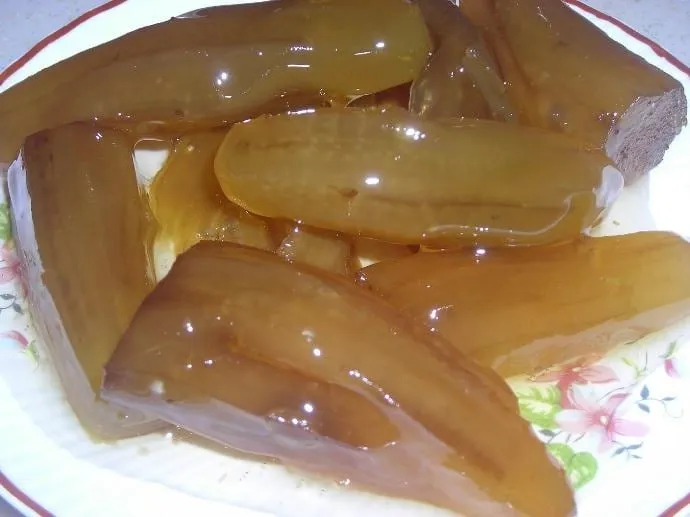
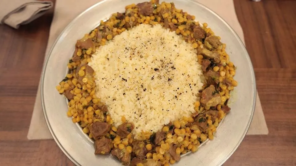
Iğdır's famous dishes and desserts
Local dishes of Iğdır cuisine:
Soups
- Gatığaşı
- Kelecoş
- Ayranaşı
- Hörre
- Süt hörresi
- Sabahaşı
- Helise
- Perzana
Main dishes
- Taş köfte
- Tavuk şorva
- Tandır şiş
- Ekşili
- İşkembe kavurma
- Cızdık
- Paça
- Bozbaş
- Yağ şorvası
- Etli sarma
- Cılvır
- Salmanca
- Omacaşı
- Ekşili pilav
- Kuru üzümlü pilav (pilaf with raisins)
- Keklik etli lepeli pilav (pilaf with partridge)
- Sütlü pilav (milk pilaf)
- Börülceli bulgur (bulgur with black-eyed peas)
- Evelikli bulgur (bulgur with wild dock)
- Tereyağlı erişte (buttered noodles)
- Tapan
Desserts
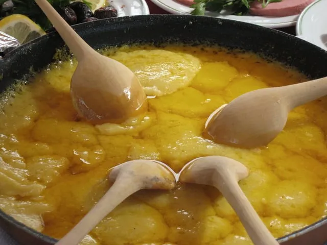
- Fetir
- Kuymak
- Omaç helvası
- Kavut
- Kaysafa
Places to visit in Iğdır
Places to visit in Iğdır: historic sites
Genocide Memorial (Soykırım Anıtı): At the ring road junction in the Baharlı neighbourhood.
Visiting hours: 07:30–14:15
Mount Ağrı (Ararat): Türkiye's highest mountain, forming the border between Iran and Iğdır. It is 5,165 metres high and is an old volcano.
Harmandöven Caravanserai: Built in the 12th century, in the Seljuk period, by Şerafettin Ejder Bey, emir of Sürmari, on the old Batumi–Tabriz caravan route of the Silk Road.
Ram-headed gravestones: Ram-headed gravestones are found in almost all the cemeteries of the Iğdır Plain. They date from the Karakoyunlu period.
Aras River: Along the banks of the Aras River, places for tourist accommodation, food and drink, rest and entertainment could be built with state support and incentives.
The places we recommend seeing when you go to Iğdır are:
- Castles of Iğdır
- Mosques of Iğdır
- Kümbets (domed tombs) of Iğdır
- Caravanserais and hans of Iğdır
- Hamams of Iğdır
- Tombs of Iğdır
- Bridges of Iğdır
- Iğdır “Genocide” Monument and Museum
- Karakale ruins, Iğdır
We have brought together in this gallery the historic and tourist places to visit in Iğdır, which borders Azerbaijan and Armenia. Places to see on your visit to Iğdır:
Karakale ruins
Built in Urartian times in a defensible spot west of the Iğdır plain, on the Armenian border. It is the region's oldest fortified settlement and has the character of a medieval settlement.
Meteor (meteorite) crater
This crater on the Korhan yayla (highland pasture) is a large pit formed when a meteorite fell in 1892. In size and depth it ranks 2nd in the world after the Barringer Crater in Arizona. It is 35 metres wide and about 60 metres deep. Many worked stones can be found around the crater, which stands out for its rich scenery and wealth of flowers.
Seljuk (Harmandöven) Caravanserai
The caravanserai on the Asmaköy road is one of the finest works of 12th-century Seljuk stonework. It was placed under protection in 1986 but is still in ruins.
Ahura ruins
Ahura is in the Yakup Valley on the northern slopes of Mount Ararat. The ruins, at 1,750 metres, are a settlement founded in the 2nd century BC in the time of the Artaxiad Kingdom.
Tuzluca Salt Caves
A site with the capacity to meet Türkiye's salt needs for 100 years. The air in the tunnels on this 55-dönüm (about 5.5-hectare) salt-covered land is known to be good for the respiratory tract. It can produce 60 tonnes of salt a day.
Ram-headed gravestones
The ram-headed gravestones found in all the old cemeteries of the Iğdır plain date from the Karakoyunlu period, which left a lasting mark on Iğdır. These stones were placed on the graves of those the Karakoyunlu considered brave and heroic, and of those who died young. The tradition came to the Karakoyunlu from Central Asian Turkic culture.
Martyred Turks Monument and Museum
It symbolises the Armenian attacks in the region between 1915 and 1920 and holds related documents. About 4,000 visitors tour the museum each month. It consists of a 350 m² indoor museum, 2 pools and 5 swords 36 m high. The surrounding area is being built as green space and a park. It is Türkiye's tallest monument.
Source: http://www.gezilebilecekyerler.com/igdirda-gezilecek-yerler/
Culture and arts in Iğdır
Iğdır, one of our rare provinces that has kept its unique character to this day with its cultural heritage, history, rich traditions and warm-hearted people, also remains, because of its geography, a symbolic province of the country's history.
Iğdır Province, known as the Çukurova (fertile lowland) of Eastern Anatolia, is suited to organic farming in today's world not only for its history but also for its fertile soils and unique nature, and with its rich tourism potential it will no doubt play an important role in the growth and diversification of Turkish tourism.
On one side is the Aras River, which rises in the Bingöl mountains, gives life to our province and then crosses our borders to flow into the Caspian Sea; on the other is Mount Ağrı, Türkiye's highest mountain, which aims to become an important centre of the country's tourism with both its mythological identity and its natural beauty, and which was declared a National Park by a decision of the Council of Ministers in 2004.
Iğdır, a favourite centre for yayla (highland pasture) tourism, birdwatching, plant study and sports such as grass skiing, paragliding, mountain biking and horse riding, also hosts the visual feast of the salt caves in our Tuzluca district and the galleries formed by countless salt rocks.
Our province, with 6,000 years of history, is rich in culture and tourism and has many historic monuments. There are a total of 65 registered cultural assets: 27 in the central district, 4 in Karakoyunlu, 7 in Aralık and 27 in Tuzluca. These cultural assets are mostly castles, cemeteries, houses, churches, caravanserais, monuments and old settlements. The province has 4 protected sites: the Korhan yayla, the old settlement of Karakoyunlu, the old settlement of Asma köy and the Kültepe mound.
Source: http://www.igdir.gov.tr/kultur-ve-turizm
History of Iğdır
The name Iğdır comes from “Iğdır Beğ”, the eldest son of Cengiz Alp, one of the six sons of Oğuz Han, and of the İç-Oğuzlar-Üç-Ok branch, counted as the 21st of the 24 Oghuz clans. Iğdır Beğ was the clan's first leader. As a word, Iğdır means “good, great, brave leader, famous and owner”, and according to Yazıcıoğlu and Rashid al-Din, “good, exalted, valiant”.
Iğdır Beğ was the eldest of four brothers. His tribe settled in the Aras basin and the Azerbaijan region. The greatest evidence for this: the Christian world, delighted that Yıldırım Beyazıt (Bayezid I) had been defeated by Timur at the Battle of Ankara in 1402, sent many envoys to Timur to congratulate him. As one of these envoys, the Spaniard Clavijo, describes, the Iğdır Kalası (Iğdır Korganı, Iğdır fortress) still stands in ruins at the foot of Mount Ağrı today. Clavijo calls it “a castle standing on a rock” and says its name was “Iğdır”.
HISTORY:
Iğdır and its surroundings have been an important settlement since prehistoric times. Although it is not known exactly when settlement began, most scholarly studies show that the Hurrians, accepted as having come from Central Asia, were the region's first inhabitants.
After the Hurrians settled in today's Azerbaijan, the Sürmeli basin and Eastern Anatolia in 5000–4000 BC, peoples such as the Mitanni, Etis (Hittites), Assyrians, Cimmerians, Medes, Persians, Sumerians and Subaeans are thought to have come from Central Asia in 3000–2000 BC and settled on the slopes of Mount Ağrı, in the Aras basin and in Eastern Anatolia.
Around 1200 BC the Thraco-Phrygians, setting out from Thrace and crossing into Anatolia via the Straits, ended the rule of the Etis (Hittites) in the region. At that time, a small kingdom in Eastern Anatolia, accepted as descended from the Hurrians and known to history as the Urartians, lived as a vassal of the Assyrians.
The Assyrians' weakening through internal strife led the KASSITE tribe in the south to seize power. The Assyrians, who later grew very strong and advanced as far as Egypt, had to recognise the Urartians, whom they could never bring under their rule.
In 1100–800 BC the Urartian Kingdom, with its royal centre at Van and all of Eastern Anatolia under its rule, set up small principalities and kingdoms attached to it. One of these is the city of “KARAKALE”, known as Sürmeli, which still stands in ruins.
Iğdır and its surroundings remained in Urartian hands until the 7th century; after that, around 665 BC, the Scythian-Saka Turks, living as mounted nomads, crossed the Caucasus into the region and ended Urartian rule.
The Dede Korkut Oğuzname, considered one of our national epics in the countries of the Near East, tells of the beys and commanders of the Sakas. The works of the Sakas, who settled on the banks of the Aras, Tigris, Kura and Çoruh rivers, survive to this day in these areas.
The Sasanians, who ruled today's Iran and Eastern Anatolia between 642 and 226 BC, under Yazdegerd II strove by trickery to destroy the Kamsarakans in Kağızman, then a principality, the Bagratids on the Aras and in Doğubeyazıt, and the Oghuz in the Muş and Malazgirt regions.
The Sasanians, who suffered a heavy defeat at the hands of the Oghuz in battles on the slopes of Mount Ağrı (Arkori-Akuri/Ahura village) in AD 481, fought the Oghuz for about 50 years in the bitterness of this defeat.
The Byzantines, closely involved with Eastern Anatolia, fought the Sasanians many times and, with the help of the Göktürks and White Huns attacking the Sasanians from the east, dealt them a heavy defeat along the Aras River.
Around 149 BC the Arsacid Turkmen nomads, who were Bulgar Turks, defeated the Sakas and made Karakale their royal centre. The region remained in Arsacid hands for 366 years; it passed briefly to the Byzantines, but the Bagratid kingdom founded in Kars took it back from the Byzantines and ruled until the 7th century AD.
After the Hurrians, the region was ruled by states such as the Mitanni, Urartu, the Medes, the Persians, the Arsacids and the Sasanians; in AD 638, under Caliph Omar, when Islamic armies came down to the Aras through the ARARAT province via the Doğubeyazıt plain called Gökova, it also became the scene of Muslim–Christian wars. Changing hands several times between the Arabs and Byzantines, the region came under the Seljuks (Oghuz) in 1064. The Seljuks, who also took Ani and Kars from the Byzantines in 1074, became the definitive rulers of the region.
The MONGOL invasion, sweeping in from the east like a hurricane and destroying everything in its path, reached the region in 1239. After the Mongols weakened, here as in many regions, Turkish beyliks such as the KARAKOYUNLU and AKKOYUNLU ruled, if only briefly.
Although the region passed definitively to the Ottomans with the Battle of Chaldiran in 1514 and the Tabriz campaign of 1534, the weakening of the Ottoman state through political developments also affected Iğdır's fate.
The region was under Iranian rule between 1746 and 1827 and, at the end of the Ottoman–Russian war of 1877–78 (the War of '93), suffered 42 years of Russian occupation. After the October Revolution of 1917 (the Bolshevik Revolution), Russia, seeking to escape its political crisis, signed the Treaty of Brest-Litovsk with other states and the region passed back to the Turks; but when the army withdrew from the region under the Armistice of Mudros of 30 October 1918, the area became the scene of Armenian atrocities.
While withdrawing from the Ottoman lands it had occupied under the Treaty of Brest-Litovsk, Russia also encouraged the Armenians, whom it constantly used like puppets, to believe they could found a great Armenian state in the region.
The Armenian terrorist organisations called “Tashnak”, “Sutyan” and “Hunchak” began to wipe out the Turkish population of the region through unimaginable torture and massacre in order to found an Armenian state there. Many mass graves remain from these massacres. In 1986 a team led by Prof. Dr. Enver KONUKÇU opened a mass grave in the village of Oba in the central district and showed it to Turkish and world opinion. Later, mass graves in the villages of Hakmehmet and Gedikli were also opened, registered by the authorities and presented to the public.
Living witnesses of the events have for years told of mass graves in villages such as Küllük, Hakmehmet, Hakveyis, Kadıkışlak and Alikamerli, as in Oba.
Finally, on 14 November 1920, when the heroic Turkish army under Kazım KARABEKİR, Commander of the 15th Army Corps, drove the Armenians back north of the Aras River, Iğdır and its surroundings became for good an inseparable part of Türkiye's sacred lands. Indeed, 14 November is celebrated every year in the region with ceremonies as the anniversary of the province's liberation from enemy occupation.
HISTORICAL CHRONOLOGY
4000–810 BC Hurrians; 810–785 BC Urartians; 785–400 BC Sakas; 400 BC–AD 200 Independent period; AD 200–439 Lesser Arsacid State; 439–646 Sasanians; 646–1064 Muslim Arabs; 1064–1239 Kayı; 1239–1256 Genghisids; 1256–1355 Ilkhanids; 1355–1404 Turkmen beys under Timur; 1404–1469 Karakoyunlu; 1469–1502 Akkoyunlu; 1502–1514 Safavid State; 1514–1736 Ottoman Empire; 1736–1827 Iranian State (Erivan Eyalet); 1827–1917 Russian rule (Sürmali sanjak); 1917–1920 Armenian occupation; 14.11.1920 liberation from Armenian occupation; 1934 Iğdır becomes a district; 27 May 1992 Iğdır becomes a province. Iğdır, whose first municipal organisation was set up in 1923, became a district centre in 1934, and became a “province” under Law No. 3806, which entered into force on publication in Official Gazette No. 21247 of 3 June 1992.
Under the same law, the town of Karakoyunlu was also given “district” status and attached to Iğdır Province together with the districts of Aralık and Tuzluca.
Iğdır Province, in the Erzurum–Kars section of the Eastern Anatolia Region, has its northern and northeastern border formed by the Aras River and the Armenian border running along its bed. To the east and southeast of the region are Nakhchivan and Iran, to the south Ağrı Province, and to the west and northwest Kars Province.
Source: http://www.igdir.gov.tr/tarihi
Getting to Iğdır
By road: links with the surrounding provinces, districts and neighbouring countries are by road only. By air: fly to Kars Airport and continue to Iğdır by road.
Districts of Iğdır
- Iğdır (provincial centre)
- Aralık
- Karakoyunlu
- Tuzluca
Economy of Iğdır
Iğdır's economy depends largely on farming. The plain watered by the Aras River is one of Eastern Anatolia's important crop-growing areas. About 74% of its orchards are apricots; 15,206 tonnes of apricots were produced in 2008. Tomatoes, melons and watermelons also grow in abundance.
The Şalak apricot is an early variety that grows only in Iğdır and Kağızman; it ripens in the last week of June, and its kernel is sweet and eaten as a nut. Sugar beet production began with the founding of the Erzurum Sugar Factory in 1956. Cotton was grown for a time but was almost abandoned after the 2000s.
In livestock, sheep farming comes first; the local Mor Karaman sheep is raised. Because of snow, animals spend 4–6 months of the year in pens.
Border trade at the Dilucu border crossing was permitted in 1992, and over time trade overtook farming and livestock. The salt deposits in Tuzluca hold reserves of about 800 million tonnes. Industry is limited; flour, biscuits, salt, feed and bricks are produced.


Comments
Loading comments…