
Kırıkkale
- Central Anatolia Region
About Kırıkkale
Kırıkkale, in the Middle Kızılırmak section of the Central Anatolia Region, is a city that borders Çorum and Yozgat to the east, Kırşehir to the south, Ankara to the west and Çankırı to the north. With 9 districts, 11 towns and 185 villages, it covers 4,356 square kilometres and has a population of 271,092.
The Kızılırmak, which runs for a total of 94 kilometres along the city's south and west, offers unique nature with dozens of highland pastures and parks. Kırıkkale is also an important industrial centre, with the Tüpraş refinery, the plants of MKEK (Mechanical and Chemical Industry Corporation) and the Kırdemir Kırıkkale iron and steel works within its borders.
Although there are many stories about the city's name, according to the Kırıkkale Governor's Office it is said to have come from shortening and combining Kırıkköyü, 3 kilometres north of the city, and Kaletepe in the city centre. Although it is widely believed that the name was coined by the people, the area's name appears in Ottoman archive documents in its present form, Kırıkkale. The historic remains, ruins and mounds within today's provincial borders, and the archaeological finds from before Christ found in some surveys and studies, show what an old place of settlement Kırıkkale's land is.
Kırıkkale's famous dishes and desserts
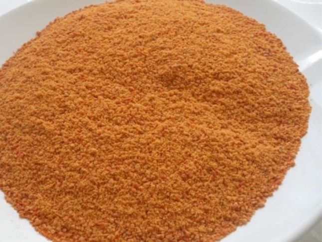
Never without tarhana: un tarhanası
Tarhana is one of the warmest, most homely flavours of Turkish cooking. It is made with small variations in different regions, and in Kırıkkale's kitchen it appears as un tarhanası (flour tarhana).
The dough, kneaded with plenty of flour, tomatoes, peppers, salt and yoghurt, is left to ferment for a long time. It is then dried in small pieces, crumbled by hand and finally passed through a sieve, ready to be used all year. It smells wonderful and is enjoyed as soup.
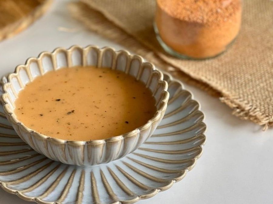
Did we say how much we love it: yoğurtlu tarhana çorbası
You may never have seen tarhana like this before, but you should discover this flavour as soon as possible. Its journey starts with cracked wheat and yoghurt being combined and dried. It ends again in a pot, and it is customary to serve it with mint fried in butter drizzled on top. You'll never get enough of it!
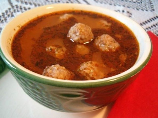
One plate fills you up: tuvalak
Tuvalak is a very filling local dish because it contains both meat and bulgur. You can fill yourself up with one plate of tuvalak; chickpeas can also be added if you like, and every version is delicious.
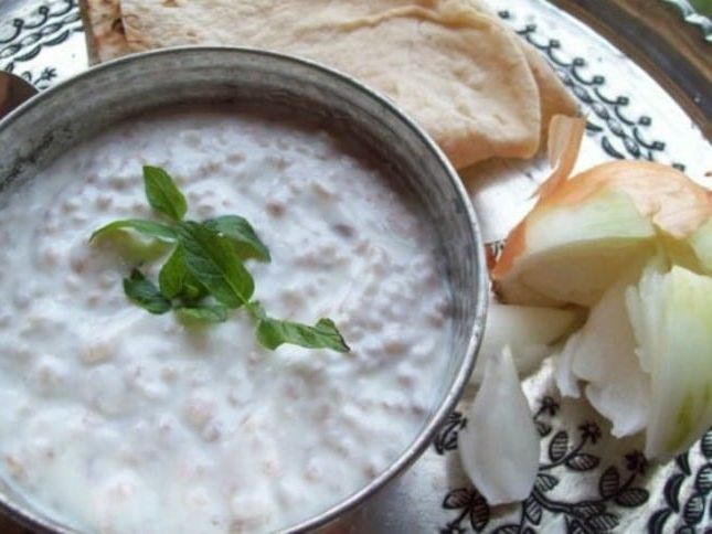
Also called bulama: katma aşı
Katma aşı, one of the local dishes most often made in and around Kırıkkale, is also known as bulama. This simple recipe, made by adding cracked wheat to ayran and boiling it, turns out to be unexpectedly tasty for something so easy. The more you eat, the more you want.
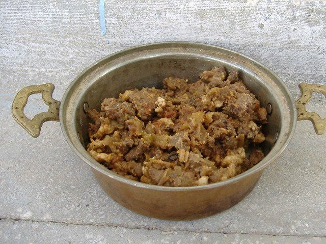
For those who aren't full without meat: sızgıt
Sızgıt, also known as et kavurması (preserved fried meat), is made with small variations in various regions. But sızgıt also has a special place in Kırıkkale's kitchen, and nothing beats eating it there.
If you ask what sızgıt is, we can say it is a delicious dish made by frying small pieces of meat in their own fat or in tail fat and then drying them. And because it is dried, it can be kept safely for a long time. For this reason sızgıt is generally made most after the Feast of Sacrifice and then added to different dishes for a long time afterwards. If you want to eat it on its own, just warm it up well in a pan. What more could you want!
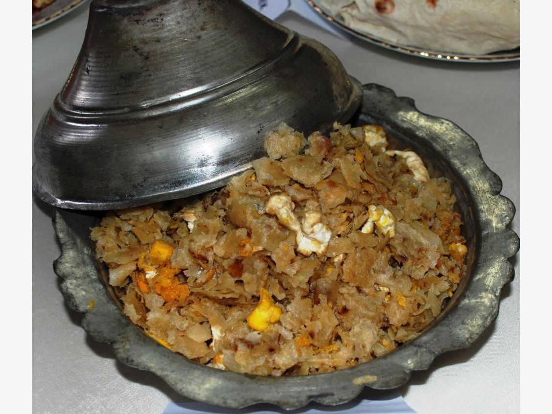
Nothing is this easy: omaç
Making a tasty dish with just three ingredients isn't always easy. But once you discover this local flavour from Kırıkkale's kitchen, you'll see that wonders can be made with three ingredients.
In its simplest form this delicious dish is made of yufka, eggs and butter. Those who wish can enrich it with other ingredients or spices. But even the plainest version is enough to win everyone over.
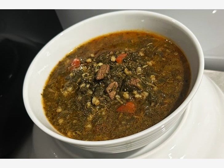
You can't get enough of it: madımak
This dish, starring madımak (knotgrass) and also containing bulgur, tomato paste and meat, is a staple of Anatolian cooking. It is made a lot in Kırıkkale too, and with garlic yoghurt and sizzling butter drizzled over it you can't get enough of it; if you haven't tried it yet, we say don't wait.
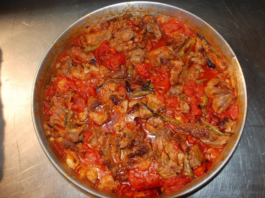
Never leave without trying it: Keskin tava
If you find yourself in Kırıkkale, Keskin tava is at the top of the dishes you should never leave without trying.
Made with lamb, this local dish becomes finger-licking good, and favourite companions such as tomatoes and peppers are never left out. Delicious.
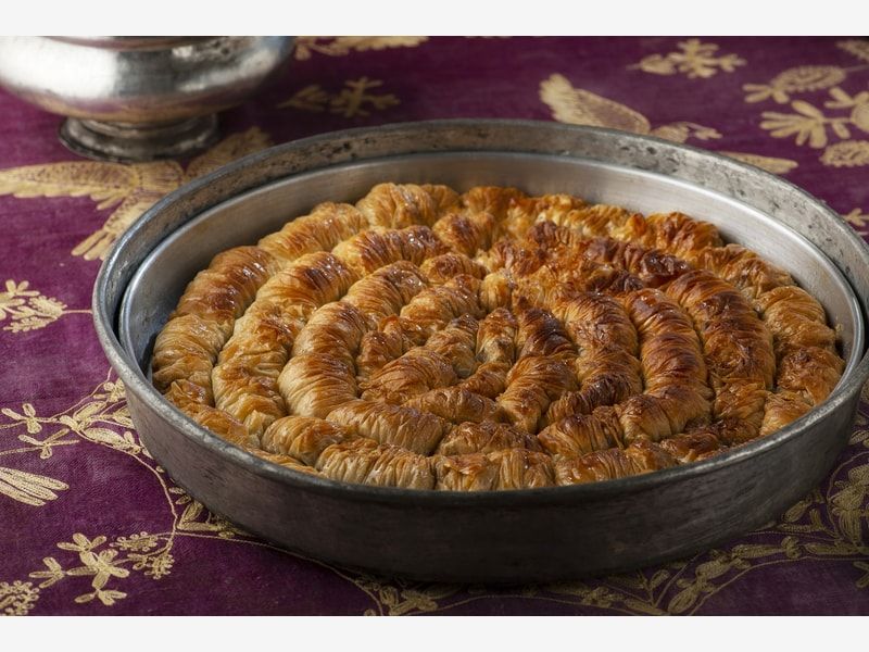
Syrup desserts are our speciality: sarığı burma
Syrup-soaked desserts are one of the best things about Turkish cooking, so how could you go to Kırıkkale and not eat a sarığı burma (twisted turban) there? Never mind the syrup and the lovely yufka, just the look of it is enough to make you eat trays of it.
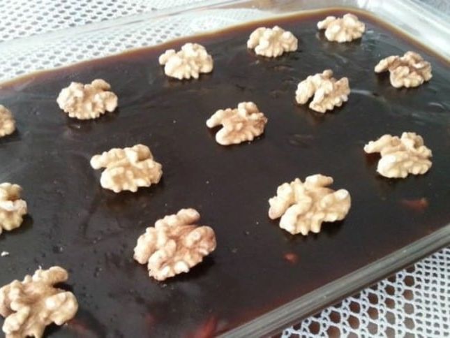
It makes you love pekmez: haside (pekmez peltesi)
This delicious dessert, made with the pekmez (grape molasses) you will find in abundance in Kırıkkale, is basically made with just 3 ingredients: pekmez, flour and butter.
And yet it offers a flavour far beyond its simplicity, and makes even those who don't like pekmez love it.
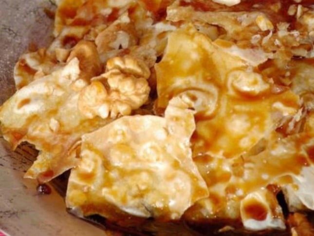
Kırıkkale gives pekmez its due: gölleme (batırma)
A carefully prepared yeasted dough comes together with butter and grape pekmez. Some also add walnuts on top. This local dish of Kırıkkale is known as gölleme or batırma.
Gölleme is one more reason to love Kırıkkale's kitchen, where pekmez is used generously.
Source: https://yemek.com/kirikkale-yemekleri/sayfa/11


Places to visit in Kırıkkale
Kırıkkale, which became a province only recently, is in fact a very old place of settlement. Its mosques, tombs, caves and underground cities support this. If you are preparing a list of places to visit in Kırıkkale, you can take a look at this page.
Kırıkkale is very rich in highland pastures (yaylas). Your list could include the Hodar, Bedesten, Sarıkaya, Gümüşpınar, Yeşilkaya and Azgın yaylas. On the yaylas, clean air and peace will be waiting for you along with plenty of greenery.
Sulu Mağara (the Wet Cave) is one of the places we suggest putting near the top of your list. Sulu Mağara is at Arzu Bayırı in Keskin district and is not hard to reach. The cave is part natural and part man-made. It is 285 metres long, and its natural part has three levels. The Kırıkkale Governor's Office and the Special Provincial Administration have carried out works and improvements in Sulu Mağara and made it ready for visitors. You should include Sulu Mağara, a witness to the city's history, in your visits.
The Ceritkale rock tombs, which reveal the city's history, are another place we recommend you see. Considered the oldest settlement in the area, the Ceritkale rock tombs are very close to the village of Ceritkale in Keskin district, 3 kilometres away.
Kırıkkale's religious sites, such as its mosques and tombs, are also visited by tourists who come to the city. The Hasandede Mosque and Tomb is a historic place of worship built in 1605. Because the mosque is 12 kilometres from the city centre, it is easy to reach. The mosque was built of cut stone on a square plan. The Hasandede Mosque and Tomb could be among the places you add to your Kırıkkale trip.
Kırıkkale's historic sights are not limited to these. The Şeyh Şamil Mosque and Tomb, the Ballı Mosque and Tomb, the Koçubaba Mosque and Tomb and the Haydar Sultan Mosque and Tomb could also go on your list.
Places to visit in Kırıkkale: historic sites
Çeşnigir Bridge

Çeşnigir Bridge, a Seljuk-period work, is in the town of Köprüköy in Karakeçili, one of Kırıkkale's districts.
Little is known about Çeşnigir Bridge. Architectural study has shown that it dates from the 13th century. The only thing known for certain about the bridge is that Yavuz Sultan Selim had it rebuilt on his way to the Egyptian campaign. Çeşnigir Bridge was open to vehicle traffic until 1898. But after the Kapulukaya Dam was built it was closed to vehicles.
The bridge was built of cut stone. It is 110 metres long in total and 6 metres wide.
Arms Industry Museum

The Arms Industry Museum, which first opened in 1990, is in Kırıkkale's central district.
The Arms Industry Museum displays a total of 299 items, including pieces collected during the Second World War and many items from the arms factory at Tophane in Istanbul.
The whole collection is arranged in chronological order. The Arms Industry Museum was enlarged and moved to a new space in 1993.
Hasandede Mosque

The Hasandede Mosque is one of Kırıkkale's places of worship. The architecturally impressive building is in the town of Hasandede in the central district.
The mosque is 12 kilometres from the city centre. Right next to the mosque there is a tomb. The tomb holds the graves of Hasandede, his sons Şeyh Halil İbrahim and Şeyh Mustafa, and his daughter Ümmühan Ana. The Hasandede Mosque was designed on a square plan and built of cut stone.
The Hasandede Mosque, one of the first stops on any Kırıkkale trip, should definitely be on your list for its architecture and interior decoration. The Ceritkale rock tombs and Sulu Mağara, among Kırıkkale's spots waiting to be discovered, should also be on your list.
Ceritkale rock tombs

The Ceritkale rock tombs in Keskin, Kırıkkale, are one of the oldest settlements in the area. They are also very close to Sulu Mağara, another of the city's sights.
Because the Ceritkale rock tombs are in the village of Çeritkale, about 9 kilometres from the district centre, they are easy to find. Research has shown that the rock tombs have a long history going back to the Iron Age.
If you are preparing a trip to discover Kırıkkale, with its tourism potential, you should definitely see the Ceritkale rock tombs and Sulu Mağara in the same area.
Sulu Mağara (the Wet Cave)

Sulu Mağara, one of Kırıkkale's sights, is in Keskin district. It is at Arzu Bayırı and is easy to reach.
The cave was first studied in 1996. Studies suggested that the cave was a settlement in the Byzantine period. But the cave's name has not been found in any source. Sulu Mağara is a part-natural, part-man-made cave.
This spot in the village of Ceritkale is one of the top places to include on a Kırıkkale trip. If you are planning a trip to Kırıkkale, we recommend you include Sulu Mağara in your days in the city.
Source: https://www.gezilebilecekyerler.com/kirikkalede-gezilecek-yerler/
Culture and arts in Kırıkkale
Cultural heritage and art
OLD HOUSES
Some of the Ottoman-period old houses and mansions in our area are still preserved. Our districts, towns and villages have houses that keep their original structure. These houses generally have 2 storeys, with rooms opening off a large hall. In the stone and mudbrick buildings, the windows, doors and ceilings are of carved wood. In the sections called yüklük (bedding cupboards) you can see fine examples of woodwork. Woodwork made and decorated with techniques of chiselling, carving, inlay, veneer, moulding, turning, pyrography and gilding has been found especially in the Ballı Mosque in Balışeyh, the Pehlivanlı Mansion in Beyobası, and in Ottoman-period religious and civil architecture in Keskin.
HANDICRAFTS
Handicrafts are very widespread in our province and are kept alive especially through the work of the Public Education Centres in the area. At the courses and exhibitions held, handicrafts made with tools such as the needle, shuttle, crochet hook and hairpin lace fork are displayed, showing the fine examples particular to each technique. Needle lace can be divided into groups such as ulamalar, hotoz lace, crown lace, branch lace, and flowerpot and wild-flower lace. The lace generally copies natural beauty, and care is taken to use all the colours in nature as well as geometric shapes. Bead lace uses thread and coloured beads.
This lace is used especially on the yemeni (headscarves) women wear, on some folk-costume headdresses, on bed, table and side-table sets as covers, or as an accessory in a corner of the house.
WEAVING
Carpet and kilim weaving used to be very widespread in our province. But today, as a result of social and economic development, this tradition is being forgotten. In our districts of Karakeçili, Keskin, Balışeyh and Sulakyurt there are still old looms, but they are rarely used. Research in the area has found that old carpets and kilims were used spread on floors, sedirs and divans. The area's carpets and kilims have no single dominant colour or pattern. Generally 4 main colours were used, decorated with patterns. Karakeçili carpets and kilims are the preferred weavings. Carpets, cushions, saddlebags, prayer rugs and runner carpets are popular products.
KESKİN WEAVING
Source: http://www.kirikkale.gov.tr/kulturel-varliklar-ve-sanat
History of Kırıkkale
Historical formation
The province's name: Kırıkkale's name is said to have come from shortening and combining Kırıkköyü, 3 km north of the city, and Kaletepe in the town centre. Although it is widely believed that the name was coined by the people, the area's name appears in Ottoman archive documents in the form Kırıkkal'a, close to its present form.
It is known that in the 16th and 17th centuries various Turkish tribes and communities coming from the east were settled in Anatolia, especially Central Anatolia. Documents state that a large clan called "Oğuz, Oğuzhan" was settled near Ankara, at "Kırıkkal'a" as it was then pronounced.
The Oğuz clan, said to belong to the Yörükan group, is a large tribe, also known as "Türkmen", that made Anatolia a Turkish homeland by Turkifying and Islamising it. So we must accept that the area's name has a history of at least 400 years.
a. Before the Turks: The area has a very old history. The historic remains, ruins and mounds within today's provincial borders, and the archaeological finds from before Christ found in some surveys and studies, show what an old place of settlement Kırıkkale's land is.
KIRIKKALE'S ANCIENT HISTORY
No archaeological excavation has yet been carried out that would shed light on the ancient history of Kırıkkale province and its surroundings. But there have been some scholarly efforts that throw light on the region's historical geography. Surface surveys carried out within our provincial borders by the Japanese team excavating at Kaman-Kalehöyük in Kırşehir have produced notable findings.
THE CHALCOLITHIC AGE IN KIRIKKALE PROVINCE AND ITS SURROUNDINGS
In the Japanese surface surveys of 1990–91, covering the centre of Kırıkkale and its districts and villages, a total of 21 mounds and flat settlements were identified. Evaluation of the pottery collected from these sites found, in the area outside the Kızılırmak bend, settlements of the Neolithic and after, and in the area inside the Kızılırmak bend, settlements and remains reflecting the cultures of the following Chalcolithic, Early Bronze Age, Assyrian Trade Colonies period, Hittite Empire period (weakly), Phrygian and Hellenistic–Roman periods, and the Byzantine, Seljuk and Ottoman periods.
THE CHALCOLITHIC AGE IN KIRIKKALE PROVINCE AND ITS SURROUNDINGS
In surface surveys in and around Kırıkkale province, potsherds collected from a natural hill east of the village of Yeniyapan in Delice district, from the 8.5 m high Kültepe 3.5 km from the village of Çongar in Delice district, from the 8 m high Sulucatepe 2 km north-west of the village of Cinali in Keskin district, and from the 8.5 m high Kuzeren mound 3.5 km south-west of the village of Kuzeren in Kırıkkale's central district have been dated to the Chalcolithic.
The Chalcolithic is generally placed between 5000 and 3000 BC. Because stone tools were used alongside metal ones, historians named this period the Chalcolithic, meaning the Copper-Stone Age. The two leading features of this culture are copper tools gradually replacing stone and painted pottery with roots going back to the Neolithic. Late in the Early Chalcolithic, a different ethnic group, probably a people from Thrace, invaded Anatolia and burned and destroyed many settlements. Little is known about the Middle Chalcolithic, an intermediate phase between the early and late Chalcolithic. Even the existence of such a phase is debated. After this long dark interval comes the last phase of the Chalcolithic, roughly dated to the 4th millennium BC. In this period, linked with groups of migrants arriving in Anatolia via the Balkans, the population and the number of settlements also increased. In Central Anatolia, Büyük Güllücek and Alacahöyük near Çorum, Alişar near Yozgat and Yazırhöyük near Ankara are among the centres with North Aegean and Balkan influence that began to spread into Anatolia in this new period. The Chalcolithic centres in and around Kırıkkale should also be seen within this sphere of influence. In this period, villages that grew steadily larger were fortified with walls; parallel to the use of metal and the economic and social vitality it brought, new professions emerged and so different ethnic groups began to live together, bringing innovations to many areas of daily life, such as cuisine, religious life and architecture.
THE EARLY BRONZE AGE IN KIRIKKALE PROVINCE AND ITS SURROUNDINGS
In surface surveys in and around Kırıkkale province, potsherds collected from a natural hill (Yeniyapan) east of the village of Yeniyapan in Delice district; from Kültepe, 110 m across and 8.5 m high, 3.5 km east of the village of Çongar in the same district; from Alibaz, 91 m across and 10 m high, built beside the bed of the Kılıç Özü stream 2 km south of the village of Efendi in Keskin district; from Kavurğalı, 210 m across and 15 m high, 2 km south-east of the village of Kavurğalı in the same district; from Armutlu, 200 m across and 13 m high, 1.5 km south-east of the village of Armutlu in Keskin district; from Sulucatepe, 100 m across and 7 m high, 2 km north-west of the village of Cinali in the same district; from Büyükkaletepe, 280 m across and 32 m high, right on the bank of the Kızılırmak 500 m north-west of the village of Köprü in Keskin district; from Yaşar Çayır, 170 m across and 6 m high, in the bed of the Ömer Kuru stream 2 km south of the village of Ceritkale in the same district; from Tepe (Kıyıhalil İnce), 155 m across and 8.5 m high, in the bed of the Kızılırmak 1 km south-east of the village of Karağıl in Keskin district, on the west of Mount Dinek, 2.5 km north-west of the village of Kıyıhalil İnceli; and from Bıyıkaydın and the Çatal Söğüt mound in the same district, have been dated to the Early Bronze Age.
THE MIDDLE BRONZE AGE IN KIRIKKALE PROVINCE AND ITS SURROUNDINGS
a) The Assyrian Trade Colonies phase: some of the pottery collected from the Kültepe mound at the village of Çongar in Delice district, from the Alibaz mound of the village of Efendi in Keskin district, from the mound of the village of Kavurgalı in the same district, from the Armutlu mound, from the Öz mound of Balışeyh district and from the Çatal Söğüt mound in the central district has been dated to the Assyrian Trade Colonies phase.
The Middle Bronze Age is dated to 2000–1400 BC and covers the Assyrian Trade Colonies and Old Hittite periods. The most striking feature of Middle Bronze Age Anatolia is the very close and organised trade relationship that began with Mesopotamia, and as a result the learning of writing.
Assyrian merchants with caravans of 200–250 donkeys brought tin, which Anatolia needed for making weapons, and fine cloths woven to southern taste, and took gold, silver and precious stones in return. Around 1925 BC, in connection with this new trading system, many market places called karum (harbour) in Assyrian were set up in Anatolia. The most famous of these was the karum of Kanesh. Kanesh, at Kültepe near Kayseri today, was also the centre of a powerful Hittite principality. In Central Anatolia, karums were also set up at Hattush (Boğazköy), later the capital of the Hittite state, at Alişar, at Acemhöyük near Aksaray and at Karahöyük near Konya. On the road from Assur to Central Anatolia, small lodging stations called wabartum (guest house) in Assyrian were set up. The legal and political status of the karums and wabartums in Anatolia is debated among scholars. According to some scholars they were the administrative centres of colonies; according to others, free trade zones that paid taxes to the local lords. In the last phase of the Colony Age, the market (karum) of Kültepe (Kanesh), together with many settlements in Central Anatolia, ended in a fire around 1725 BC. After these events, probably the result of an internal struggle among the local lords, the Hittite state began to emerge.
b) The Old Hittite State phase: in surface surveys in and around Kırıkkale province, some of the potsherds collected from the mound of the village of Kıyıhalilincili in Sulakyurt district and from the Büyükkaletepe mound at Köprü village in Keskin district have been dated to the Old Hittite period.
We said earlier that in the Assyrian Trade Colonies phase Anatolia was shared among many principalities large and small. The important ones whose names we know are Neşa (Kanesh), Hattush, Mama, Purushhanda, Kussara and Zalpa. But with Anitta son of Pithana (1750 BC), whose origins lay in Kussara, the first step was taken towards a central state in Central Anatolia. Anitta, who seized Neşa, Zalpa and Hattush, felt strong enough to take the title of Great King (Gal Lugal). About 100 years after Anitta, the Hittite state was officially founded when Labarna of Kussara, of the same line, made Hattush his capital, named the city Hattusa and took the name Hattusili (1650–1620 BC), meaning "the man of Hattusa".
Compared with the Hattian lords, accepted as native Anatolians, little is known about the origins of the Indo-European Hittites. Did they come to Anatolia from outside in a migration? From where, and when, did this migration happen? These questions have not yet been answered with satisfactory evidence. With Hattusili I making Hattusa his capital, the Old Hittite state began to develop rapidly. Having secured authority at home, Hattusili I chose Syria as his first target. Crossing the Kızılırmak south of Kırıkkale with his army, Hattusili I set out on the campaign in which he would take Alalakh, one of Syria's important cities. By taking Alalakh he gained a great advantage for further operations. On his way back he advanced towards the Euphrates and crossed to the far bank of the river near Malatya. The land of Arzawa in western Anatolia was conquered. Under the next king, Mursili I, Aleppo was brought within the Hittite state's borders and Babylon was conquered (1594 BC). In this way the Hittites quickly made their name as one of the effective political powers of the Near East. The expansion of the Old Hittite state ended when Mursili I was murdered in a plot on his return from the Babylon campaign.
It is striking that the settlements of this age within our provincial borders are very few. Still, that this period is represented in our region at all is an important finding for the province's ancient history, and it should be assessed within the cultural fabric described above. Considering the period's importance for Anatolian history, the value of an archaeological excavation in our region is easier to understand.
THE LATE BRONZE AGE IN KIRIKKALE PROVINCE AND ITS SURROUNDINGS
In surface surveys in and around Kırıkkale province, some of the potsherds collected from the Kültepe mound at the village of Çongar in Delice district, from Beşiktepe at the village of Harekli in Delice district and from the Öz mound 4.5 km north-east of the town of Balışeyh have been dated to the Hittite Empire period.
The culture of the Hittite Empire period is in almost every respect a continuation of the Old Hittite culture, whose foundations were laid in the Colony Age. The grandest monument of the Hittite Empire period is the capital Hattusa itself. The second most important centre of Hittite civilisation is Alacahöyük, near the capital. Its reliefs are of great importance as the first monumental examples in the world of the Near East. Maşathöyük near Zile, Alişar near Yozgat, Ortaköy near Çorum, Arslantepe near Malatya, Korucutepe in Altınova, Elazığ, and in the south Tarsus-Gözlükule and Mersin-Yümüktepe are among the other leading Hittite centres.
Although it is certain that the centres within our provincial borders represent the same cultural tradition, their place in and contribution to this culture will become clear only through an archaeological excavation.
The period between 1200 and 800 BC is called the "Dark Age" because no cultural remains have been found in Anatolia. It is assumed that the people or peoples who caused the fall of the Hittite Empire lived as nomads for some 400 years, engaged only in herding. This is how the lack of any cultural remains from this period is explained.
THE IRON AGE IN THE PROVINCE AND ITS SURROUNDINGS
In surface surveys in and around Kırıkkale province, some of the pottery collected from the Kültepe mound at the village of Çongar in Delice district, from Beşiktepe at the village of Harekli in Delice district, from the Kavurgalı mound in Keskin district, from the Armutlu mound at the village of Armutlu, from the Büyüktepe mound at the village of Köprü, from the Yaşçayır mound at the village of Ceritkale, from Horpağan Tepe at the village of Karağıl, from Acıözü at the village of Kevenli, from Höyüktepe at the village of Çifteli, from the Sarımusalı mounds at the village of Kaldırım, from the Bıyıkaydın mound in Sulakyurt district and from the Çatal Söğüt mound in the town of Hasandede has been dated to the Iron Age.
The main reason this age is called the Iron Age is that most of the period's weapons and other tools were made of iron. Another reason for the name is that from the end of the 9th century BC Anatolia was again shared among many powers large and small, as at the end of the 3rd millennium BC. The renewed density of settlement in our region in this age is striking. That in almost every centre of the Hittite heartland in Anatolia a Phrygian settlement was built over the Hittite one is also important as a reflection of the period's population density. The Japanese identified part of the pottery collected from the mounds in and around Kırıkkale as Iron Age pottery and linked it to the Phrygians.
The Phrygians came to Anatolia across the straits in the early 1200s BC, during the Trojan War, and were able to found a state, with its centre at Gordion near Polatlı, only in the second half of the 8th century BC.
Considering the position and size of the Büyükkaletepe mound within our provincial borders, and the typical Phrygian pottery with deer motifs found on its surface, it is clear that this centre was an important Phrygian settlement. There is no doubt that an archaeological excavation at this mound would contribute greatly to shedding light on the province's ancient history.
THE ROMAN AND BYZANTINE PERIODS IN KIRIKKALE PROVINCE AND ITS SURROUNDINGS
Some of the potsherds collected from Sulucatepe at the village of Cinali in Keskin district, from the flat settlement of the village of Ortasöken, from the flat settlement at Kılıç near the village of Haydardede, from the Sarı Musalı mound at the village of Kaldırım and from Hopağan Tepe at the village of Karaağıl in Çelebi district, from the mound of the village of Bıyıkaydın in Sulakyurt district, from the Öküztepe flat settlement of the village of Kazmaca in our province, from the Asar mound in the town of Hacılar in the central district, from the Kuzeren mound at the village of Kızıldere in the central district and from the Çatal Söğüt mound in the town of Hasandede have been dated to the Roman and Byzantine periods.
Roman and Byzantine potsherds were collected in abundance from the flat settlements in the Kızılırmak bed, especially from the mounds in the area stretching south from Kırıkkale. No prehistoric material was found at the mounds and flat settlements where many such sherds were found. This shows that new settlements were founded in the Roman and Byzantine periods. Another notable feature is that most of the mounds were built on natural hills. And, following the general rule, most of these mounds have running water or a spring beside them.
Roman rule in Anatolia began in 129 BC with the annexation of the Kingdom of Pergamon. The territory of the Pergamene state was reorganised as Provincia Asia, the first Roman province in Anatolia. Ephesus was chosen as the province's capital.
Although it has not been fixed with certainty, the date when Cappadocia began paying taxes to Rome as a Roman province is generally accepted as 63 BC. The province of Cappadocia was bounded by the Black Sea (Pontus Euxinus) east from Samsun (Amisos) to the north, the Euphrates and Greater Armenia to the east, the Taurus Mountains to the east, and Galatia and Pamphylia to the west; its capital was Kaisareia (Kayseri). After the Roman Empire split in two in 395 BC, the province of Cappadocia remained within the borders of Eastern Rome.
Study of the historic coins found in Sulakyurt district and displayed in the Museum of Anatolian Civilisations in Ankara has shown that Romans lived in the area before Christ.
After the Turks: after the victory of Malazgirt (Manzikert) in 1071, the gates of Anatolia opened to the Turks, and the region quickly became a Turkish-Islamic land. Some places within today's Kırıkkale province appear to have been among the first Islamic towns conquered at that time.
On this, Prof. Dr Beşir Atalay says: "Kırıkkale and its surroundings have a special position; that is, they are in the middle of Central Anatolia. It is a well-protected region that opened to the outside late and even then only a little. It has the feature of having been settled from the opening of Anatolia to the Muslim Turks with the Battle of Malazgirt in 1071 and of never having been occupied, even in troubled times. It is a region with little ethnic dispersion and not much mixing. Its religious homogeneity is very marked. It is the region of Türkiye that has undergone the least cultural change. It can be said that its cultural purity is largely preserved." (Papers of the VII International Literature Seminar and I International Turkic World Culture Congress, 1995 World "Year of Tolerance, Manas and Abay", pp. 159–161)
Prof. Dr Sadık Tural also says: "The lands within the borders of Ankara, Kırşehir, Konya, Çorum, Çankırı, Yozgat and today's Kırıkkale province are geographical areas the Turks greatly embraced and made their homeland, choosing them as summer and winter pastures." (Ahmet Yesevî'den Hasandede'ye Gönül Erleri, 1997, p. 215)
After the 11th century the Kırıkkale area was opened to settlement by settling Oğuz-Türkmen tribes there. On this, Prof. Dr İsmail Özçelik says: "The Karakeçili living in Kırıkkale's Karakeçili district are related to the Karakeçili living elsewhere in Anatolia. The Karakeçili are a branch of the confederation called Ulu Yörük in Ottoman records, which also included some other tribes." (Tarihten Günümüze Karakeçililer, 2003, p. 95)
There are works on the Kırıkkale area by Prof. Dr Faruk Sümer (Oğuzlar), Prof. Dr Cengiz Orhonlu (Osmanlı İmparatorluğunda Aşiretlerin İskanı), Prof. Dr Fuat Köprülü (Türk Edebiyatında İlk Mutasavvıflar), Prof. Dr Hikmet Tanyu (Ankara ve Çevresindeki Adak Yerleri) and others.
Haydar Sultan, son of Hoca Ahmet Yesevi, the great Sufi and saint of the Turkish and Islamic world, also took part in this struggle in Anatolia.
It is very likely that this struggle took place on the slopes of Mount Behrek, one of Kırıkkale's highest mountains, and around it, where the town of Konur and the villages of Haydar Sultan and Halil Dede stand. The sources even say that in the battle he fought, Haydar Sultan was taken prisoner by the infidels and imprisoned in the well in the village now known by the same name, that his tomb is here, and that he was the son of Hoca Ahmet Yesevi.
It is also known that Balışeyh district was among the first Turkish settlements founded in Anatolia at that time. The old stone mosque and tomb here were built by the Seljuks in 1121.
In fact it is appropriate to consider, study and research the history of the Kırıkkale region together with that of Ankara. Because, being so close, these places have long remained an area attached to Ankara. Considering that Ankara first passed to the Turks in 1073, it can be accepted that the Kırıkkale region too began to be Turkified and Islamised in the same years in general. Although during some of the Crusades these places passed back to the Byzantines, from the 12th century they came firmly under Seljuk rule. In later centuries many tribes and communities of the Oğuz Turkish tribes migrating from Central Asia to Anatolia were settled in the Kırıkkale region, and the area became wholly a Turkish and Islamic land.
Kırıkkale in the Republican period: as is well known, Kırıkkale is a Republican city whose foundations were laid around 1925. Its 70 years of development and growth, and its arrival at today, have come with MKEK. The land on which Kırıkkale was founded was the land of Kırıkköyü. Before 1925 Kırıkköyü was a small village of 12 households. Kaletepe, 3–4 km away, was not really a castle in the usual sense but a neglected, treeless hill of grey earth. Tree planting began there in 1960.
The main reason for the emergence of the city of Kırıkkale was the decision in 1921 to set up the İmalatı Harbiye (war production) factory here and the laying of the foundations of the cannon and munitions factories in 1925. It is known that Hüseyin Kahya, then muhtar (headman) of Kırıkköyü, and Hüseyin Avni Bey, the teacher of the village of Yahşihan, helped in these events.
On the founding and development of the city, Prof. Dr Beşir Atalay says: "It is possible to begin Kırıkkale's history around 1925. The foundations of the factories that formed the city's core were laid in 1925. After the War of Independence, the new state's new administration looked for a place in Central Anatolia for a defence industry. Since Ankara had been chosen as the capital, a place close to the capital was sought. Perhaps Central Anatolia was seen as a safe region for this kind of industry. The empty fields where Kırıkkale stands caught the committee's attention. It is said that the close interest shown to the committee by the landowners, especially Hüseyin Kahya of Kırık village, influenced the choice of this area." (Papers of the VII International Literature Seminar and I International Turkic World Culture Congress, 1995 World "Year of Tolerance, Manas and Abay", pp. 159–161)
The laying of the foundations of the Cannon and Munitions Factory in 1925 forms the core of Kırıkkale's urbanisation. As the number of factories belonging to the same organisation grows, the number of staff and workers grows too. An unprecedented rise in population follows. Housing for the newly arrived workers and neighbourhoods spread out around it in rings. The railway forms a boundary between the factories and the residential area.
At first, social facilities and a small number of staff houses for the factories' technical and administrative staff are built right around the railway station. There is not much housing, because the employees, that is, the workers, are soldiers and stay in barracks. Later, with the hiring of civilian workers, the residential areas expanded and this area became the town centre, taking the name İstasyon (Station) neighbourhood. The social facilities and businesses of the industrial area also expanded in the same place and took the name Fabrikalar (Factories) neighbourhood.
The years 1931–1941 form the second stage in Kırıkkale's development. The number of factories opened grew rapidly, and with it the need for workers. Workers came in droves from Kırıkköyü and the surrounding villages. This is also the period when random settlement of the town began. Six more neighbourhoods formed in this period: Ovacık, Yenidoğan, Hüseyin Kahya, Tepebaşı, Gürler and Kurtuluş. Some of the government offices and schools were set up and opened in this period.
Kırıkkale, which became a municipality in 1929 and a district in 1944, takes on the look of a small town. As the town's importance as an industrial city grew and under pressure from the growing population, the Çallıöz, Güzeltepe and Sanayi neighbourhoods were founded.
With the population growth and rapid migration of 1945 and the 1950s, there was a rapid influx of people not only from nearby villages but also from the provinces of the Central, Eastern, South-eastern and Black Sea regions, and Kırıkkale grew and developed. By around 1955 the residential areas had spilled north along the Samsun highway and also expanded east. The Karyaka and Kızılırmak neighbourhoods also formed in this period.
On the city's development, Prof. Dr Sadık Tural says: "In our view, what is truly important and worth studying about the city is that it is an example of national integration. First from the surrounding provinces (Kırşehir, Çankırı, Çorum, Yozgat) and later from almost every province in Türkiye, at least one family has lived in Kırıkkale. Very few people did not pass through Kırıkkale between 1934 and 1964, whether in bureaucratic or manual work. Then the factory's population stood still. First came the first retirees, in 1968 and 1969; then in 1970–1980 the idealistic master craftsmen working in the Mechanical and Chemical factories retired. Some of the retirees migrated to the towns or villages they had come from, some to other cities. Kırıkkale suddenly became a city that lost people… It occurred to no one to make Mahmutlar or Balışeyh or Yahşihan or some suitable village or town into a satellite town for the retirees."
Kırıkkale, which took in Kırıkköyü and the village of Yuva as neighbourhoods in the 1960s, increased its neighbourhoods with rapid population growth from the 1970s. From a village of 12 households around 1925, a settlement of 25 neighbourhoods and 205,208 people had emerged by 2001.
BECOMING A PROVINCE
Kırıkkale became a province under Law No. 3578 of 21 June 1989, at a ceremony held by the late President Turgut Özal (then prime minister). Its first governor, Fikret Güven, took office as governor at a ceremony on 17 August 1989.
Source: http://www.kirikkale.gov.tr/tarihi-olusumu
Getting to Kırıkkale
Because it is in the Central Anatolia Region, there are buses to Kırıkkale from every city in Türkiye. When you arrive at the bus station, 1 kilometre from the city centre, you can continue to your destination by city bus, minibus or taxi.
Another option for getting to Kırıkkale is the railway. Istanbul, Diyarbakır, Ankara and Doğu Ekspresi (Eastern Express) timetables run. There is no airport in the city centre. But those coming from far away prefer to fly to Ankara Esenboğa Airport, 115 kilometres away.
Districts of Kırıkkale
- Bahşili
- Balışeyh
- Çelebi
- Delice
- Karakeçili
- Keskin
- Merkez (central district)
- Sulakyurt
- Yahşihan
Economy of Kırıkkale
Kırıkkale's economy was shaped by industry. The munitions factory whose foundations were laid in the 1920s was decisive in the founding of the city. When the factory began production, Kırıkkale began to attract migrants.
People came from the surrounding provinces to work in the factories of the Mechanical and Chemical Industry (MKE) corporation. In the early years of the Republic, industry led the city's growth.
When the village of Kırık became a bucak (sub-district) in 1929, its population was about 3,000; in the 1935 census the city's population rose to 4,599. The city is also home to the Central Anatolia Kırıkkale Refinery. The railway line was also influential in the formation of the first settlement.


Comments
Loading comments…