
Kırklareli
- Marmara Region
About Kırklareli
Known for a history reaching back to the 6th century BC and for its rich nature and culture, Kırklareli is a city in the Marmara Region in north-western Türkiye. The city, recorded in historical inscriptions as Kırk Kilise, was renamed Kırklareli in 1924 on a proposal put to parliament by Dr Fuat Umay, the member of parliament for Kırklareli.
With its 8 districts and 173 villages, the city covers 6,550 square kilometres and has a population of 343,723. It borders Bulgaria to the north, Edirne to the west, Tekirdağ to the south and Istanbul to the south-east, and the Black Sea lies to its east.
Over its thousands of years of history Kırklareli was ruled by different civilisations such as the Thracians, Persians, Macedonians and Romans, and it has many historic churches, fountains, caves and monasteries. Thanks both to its grand historic buildings and to the Black Sea coast and beaches to the east, it draws tourists in many months of the year. But the busiest times are May–June and September, when its famous oil-wrestling festivals are held.
Like a treasure hidden in the far north of Thrace, Kırklareli is made up of the districts of Lüleburgaz, Babaeski, Vize, Pınarhisar, Demirköy, Pehlivanköy and Kofçaz. Wrapped in the magnificent nature of the Yıldız (Istranca) Mountains, this lovely Thracian city welcomes its visitors warmly. About 213 km from Istanbul, Kırklareli can be reached in a 3-hour journey. The city, formerly called Kırk Kilise, changed hands many times before it joined Ottoman lands in 1363.
Kırklareli railway station is one of the oldest buildings in the city centre. A witness to the past, the station, though not as busy as in the old days, tells us a lot about the city's history. Kırklareli Museum, where archaeological and ethnographic finds are displayed, is another cultural centre. During the conquest of Kırklareli, forty akıncı (raiders) fell as martyrs at the place now called Kırklar Tepesi. The Kırk Şehitler (Forty Martyrs) Monument was built in 1960 in their memory. Next to the monument are a school and a mosque of the same name. Like the Kırk Şehitler Monument, the Karagöz Monument is one of the city's much-visited symbolic landmarks. As Evliya Çelebi tells in his Seyahatname, Karagöz was the son of a blacksmith living in Demirköy, Kırklareli. The monument to Karagöz, a figure rooted in Turkish culture, stands here.
On Kırklareli's high hills there are castles that were important for the city's defence. The most important of these is Vize Castle, from the Roman period. The other important castle is Pınarhisar Castle, which was repaired in the Ottoman period.
Babaeski Bridge, on the Lüleburgaz road out of Babaeski, is one of the city's symbolic landmarks. It stands on the military and trade routes from Anatolia to the Balkans. To protect the six-arched bridge when the river floods, it was given flood openings and guard cells. In this respect the bridge is one of the magnificent works of art of its time.
Kırklareli's famous dishes and desserts
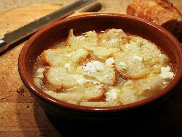
Papara
A dish from Rumelia made by soaking stale bread in buttered water and topping it with cheese or yoghurt.
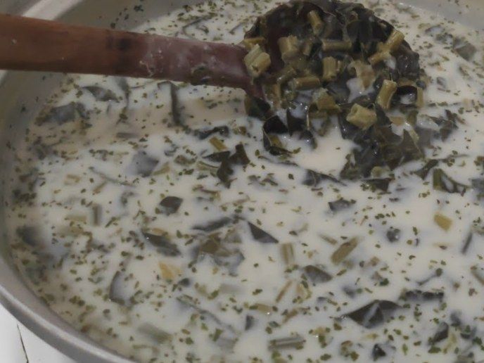
Kırklareli-style borani
Labada (dock), which grows abundantly in the area, is cooked like spinach and eaten with yoghurt.
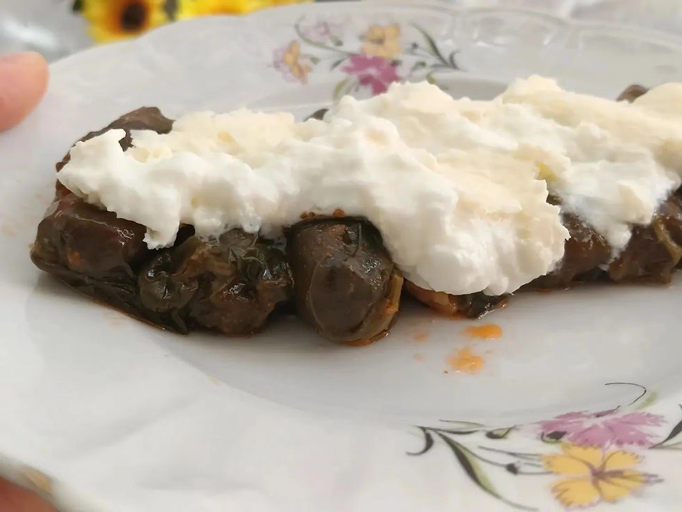
Labada sarması (stuffed dock leaves)
Made by wrapping a rice and bulgur filling in dock leaves.
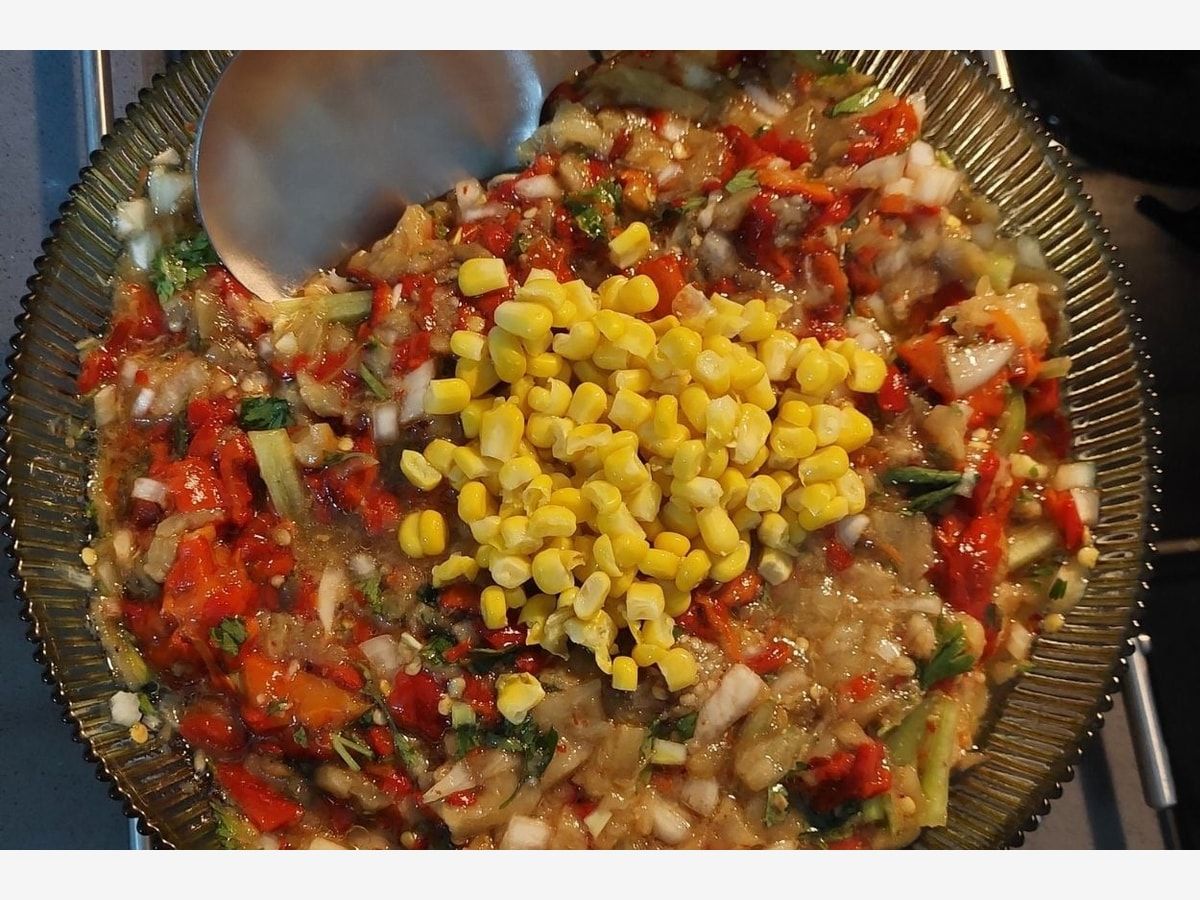
Manca
A meze made with aubergine and fleshy red peppers; it is eaten across Thrace.
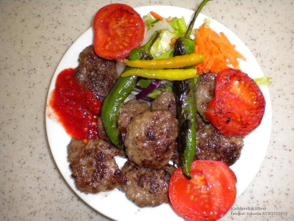
Kırklareli köftesi
Kırklareli's own grilled meatball.
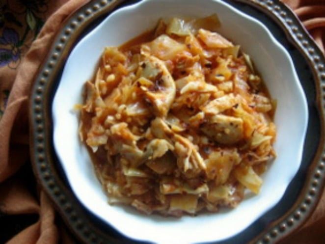
Tavuklu kalle (chicken kalle)
Cooked with pickled cabbage and its brine, with bulgur or rice and chicken added.
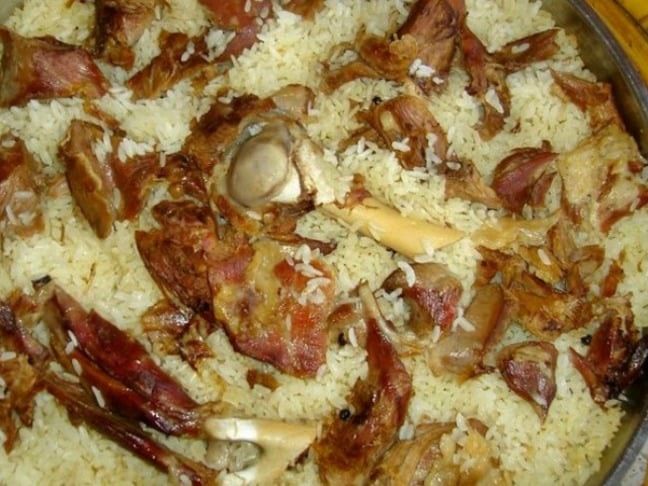
Kuzu kapama (lamb kapama)
Made by cooking lamb and rice together in one covered pot.
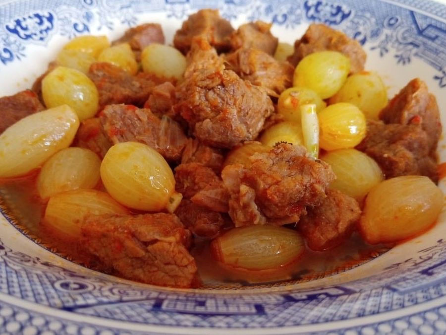
Papaz yahnisi
A stew made with meat and plenty of onions; it is also common in Edirne.
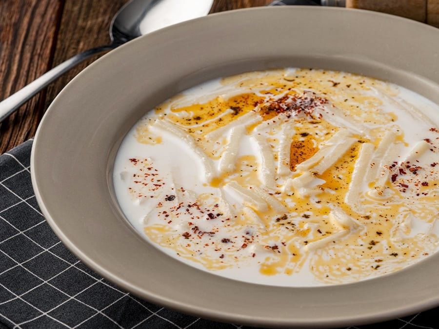
Sütlü hamur çorbası (milk noodle soup)
Also called milk soup. It is made with milk and the noodles known in Thrace as kesme.
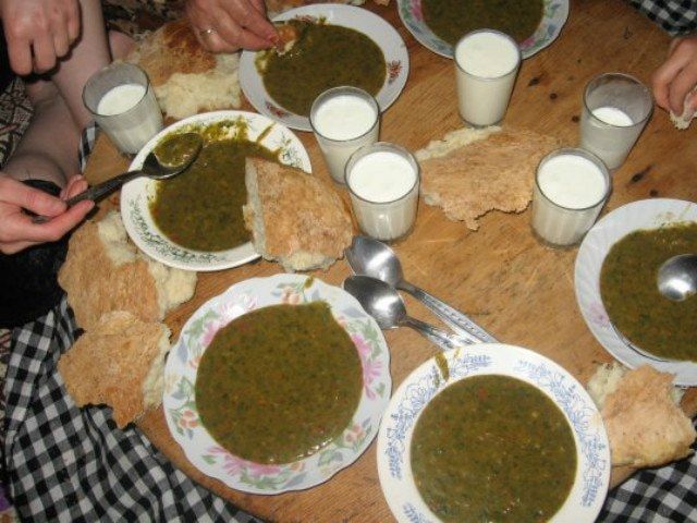
Kupriva
A dish made with nettles; like dock, nettles grow abundantly in Kırklareli.
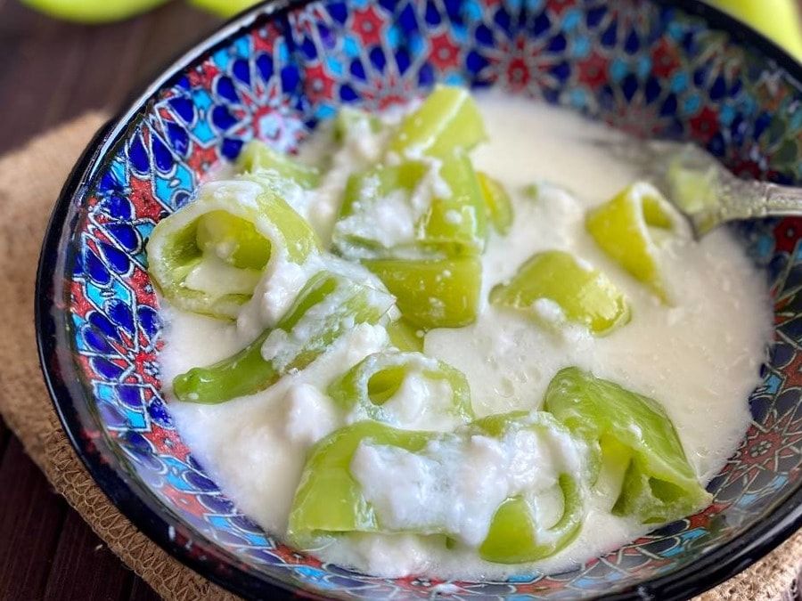
Sütlü biber turşusu (peppers pickled in milk)
A pickle in which peppers are put up in milk.
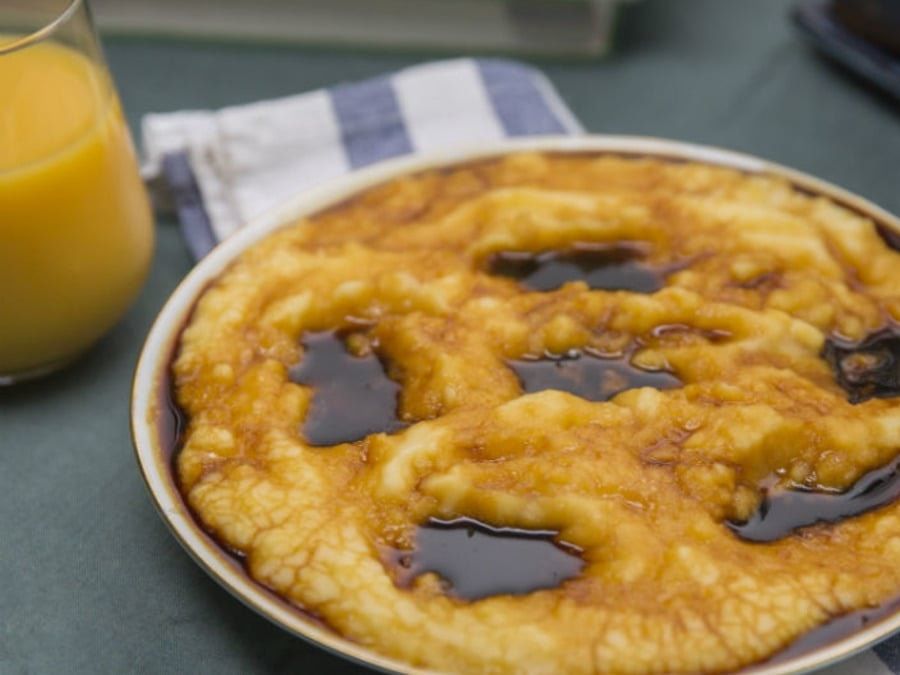
Pekmezli kaçamak
A dish brought by immigrants, made by cooking cornmeal in water and eating it with pekmez (grape molasses).


Places to visit in Kırklareli
Kıyıköy Cave
Kıyıköy Cave lies 2 km south of the town of Kıyıköy in Vize, Kırklareli. On the slope of the stream bed known locally as Büyük Kurudere, Kıyıköy Cave is a natural formation well worth seeing.
A fossil to semi-active cave formed in limestone, Kıyıköy Cave is a little hard to reach because it sits on the slope 25 metres above the valley floor. Red and brown cave moths and bats live inside the cave.
Most of the cave is dry. But you can come across small pools formed by thin trickles of water that seep in with the rain.
If you find yourself in Kıyıköy, please don't forget to add Kıyıköy Cave to your list. Have a great holiday!
Selvez Bay
Selvez Bay is 4 km from the town of Kıyıköy in Vize, Kırklareli. Selvez Bay is the quietest of the bays at Kıyıköy and is generally popular with families.
Kıyıköy, just beyond the harbour, is crowded in summer with families coming to swim. Selvez Bay is also a favourite with campers and caravanners.
A small word of warning, though: the road to Selvez Bay is rather poor, so it may be hard to get there by car. And since there is nowhere to park, we don't recommend going by car.
If you find yourself in Kıyıköy, please don't forget to add Selvez Bay to your list. Have a great holiday!
Kıyıköy Mosque
Kıyıköy Mosque is right in the centre of the town of Kıyıköy in Vize, Kırklareli.
A late Ottoman building, Kıyıköy Mosque is still in use. What makes it most interesting is that the building was built as a church and later turned into a mosque.
If you find yourself in Kıyıköy, please don't forget to add a visit to Kıyıköy Mosque to your list. Have a great holiday!
Kıyıköy Castle
Kıyıköy Castle, a Byzantine castle that surrounds much of the town of Kıyıköy, was built in the 6th century in the reign of Justinian. Judging from its mortar, the castle is thought to have been repaired in the 9th and 10th centuries.
Kıyıköy Castle was built on a slope running down to the sea between the Kazandere to the south and the Pabuçdere to the north.
Kıyıköy Castle, whose second tower no longer exists, has walls up to 6 metres high. South of these walls there is a hidden gate, reached from the castle by 180 steps. The best-preserved part of the castle today is undoubtedly the palace gate.
If you find yourself in Kıyıköy, please don't forget to add a visit to Kıyıköy Castle, which takes you deep into history, to your list. Have a great holiday!
Pabuçdere
Rising on the southern slopes of Mahya Tepe, the highest point of the Istranca Mountains, north-west of Istanbul, the Pabuçdere is one of Kıyıköy's most striking spots. The Pabuçdere flows into the Black Sea north of Kıyıköy, and where it meets the sea, right beside the town, there is a beach.
The Pabuçdere attracts many Turkish and foreign tourists, and you can take trips on it by motorboat or rowing boat. You can also fish for carp and mullet in the river. The water of the Pabuçdere is very cold but just as clean.
Between the Pabuçdere and the sea there is a narrow, long, clean beach. This area is a favourite with campers and caravanners.
If you find yourself in Kıyıköy, we recommend you don't end your trip without a boat ride on the Pabuçdere. Have a great holiday!
Panayır İskelesi Bay
Panayır İskelesi Bay is in the village of Kışlacık, 47 km from the district centre. Clearly better preserved than the other bays, Panayır İskelesi Bay has a beach 20 metres wide and about 200 metres long. The rest of the bay is covered in lush forest.
Being out of sight has made it very suitable for camping and caravan tourism. Besides the campsite, you can find limited and fairly basic seasonal facilities at Panayır İskelesi Bay.
If you carry on towards İğneada after Poliçe Bay, Panayır İskelesi Bay greets you with its unique beauty. It is often visited by campers and caravanners, and by motorcycle groups. The sea at Panayır İskelesi Bay is very clear and clean, and in places you can see coastal formations that have slid into the sea. Panayır İskelesi Bay is also a stop for turbot fishermen.
Within walking distance of Kıyıköy, Panayır İskelesi Bay enchants you with its unspoilt beauty and its view of the endless, wild waves of the Black Sea.
If you find yourself in Kıyıköy or İğneada, please don't forget to add Panayır İskelesi Bay to your list. Have a great holiday!
Poliçe Bay
Poliçe Bay is within the boundaries of the village of Kışlacık in Vize, Kırklareli. Just north of Kıyıköy, between Kıyıköy and Panayır İskelesi, Poliçe Bay is a real feast for the eyes.
Poliçe Bay, very charming to look at, stands out for its beach set among cliffs. With a forest wrapping round behind it, Poliçe Bay is a favourite with campers and caravanners.
Poliçe Bay is within walking distance of Kıyıköy. You can reach Poliçe Bay by following the paths through the forest.
If you find yourself in Kıyıköy, please don't forget to add Poliçe Bay to your list. Have a great holiday!
Kanlıgeçit Höyük (mound)
Kanlıgeçit Höyük, south of the centre of Kırklareli, is one of the places that tell us about the city's early settlements.
Kanlıgeçit Höyük is 300 metres from Aşağı Pınar Höyük, another historic site in the city. The mound is divided into three parts: north, east and south. The site was identified by Prof. Dr Mehmet Özdoğan, who also identified Aşağı Pınar Höyük.
The first archaeological excavations at the mound began in 1994, and many remains have been uncovered. After Aşağı Pınar Höyük you can stop at Kanlıgeçit Höyük too and round off your day with a full trip.
Aşağı Pınar Höyük (mound)
With a very long history, Aşağı Pınar Höyük is only 3 kilometres from the centre of Kırklareli. The mound was first noticed in 1980, when it was recorded under the name Salhana.
New excavations at Aşağı Pınar Höyük began in 1993. Research and excavation brought new remains to light and showed that the area was settled in the Neolithic. Rich in remains relating to the region's history, Aşağı Pınar Höyük covers an area of 3,000 square metres. Kırklareli's largest archaeological excavation site, Aşağı Pınar Höyük should definitely be on your list.
Beğendik village
If we told you that in the far west of our country there is a different world, with an unpolluted sea and magnificent nature, many people would say "I know" and guess wrong.
On this page we will tell you about a place in Thrace like no other: the village of Beğendik. Beğendik, in Demirköy, Kırklareli, will give you a holiday unlike any you are used to.
The village, on the Bulgarian border, has a sea so clean it will enchant you. You will be surprised at how uncrowded the sea is. That it has stayed unspoilt and unpolluted shows that it is not a well-known spot. You can't have long holidays in Beğendik, because there is no accommodation in the village or by the sea. But you can drive there for a weekend and stay a day. Believe us, in that one day your spirit will be completely renewed.
Kıyıköy Kastro beach
Kıyıköy Kastro, in Kırklareli, has no accommodation around it because it is a protected site. It is easy to reach, but as you approach Kastro the road gets a bit rough, which may make things harder.
After passing Çerkezköy and Saray, follow the signs for Kıyıköy and Kastro, and 30 kilometres later you will reach this natural wonder. Although there is no accommodation on Kastro beach, which has a very clean beach, you can easily pitch a tent and camp in the area. There is a shop at Kıyıköy Kastro beach. The sea on one side, the river on another and forest as far as the eye can see on the other… You can spend a weekend here to have an unforgettable time at Kıyıköy Kastro beach, a true natural wonder. With its unspoilt nature and camping options, Kıyıköy Kastro beach is ready for fun times with your friends.
Pınarhisar Castle
With the İğneada Longoz forest, the village of Balkaya and Dupnisa Cave, Kırklareli is visited by many tourists during the year. It welcomes its guests with its unique atmosphere, sometimes among greenery and sometimes among ruins that reveal its history.
Pınarhisar Castle is among Kırklareli's surviving ruins. The castle, in the district of Pınarhisar, has no inscription. Only its style shows that it was built in the Byzantine period as a guard post. Pınarhisar Castle, which has survived intact, is well built. You can add this historic site, one of the places to visit in Kırklareli, to your trip. You too will be amazed at how sturdy it has remained since Byzantine times.
Vize Castle
Vize Castle, which shares its name with the district of Vize in Kırklareli, stands on the highest hill in the district.
Most of the remains have survived and are among the region's sights. The castle is divided in two: an inner castle and an outer castle. It was built of cut stone laid with strong mortar. The surviving walls and castle are dated to the Roman period. Research at Vize Castle found an inscription written during a repair of the walls. The inscription reads: "The castle towers were built under the direction of Firmus son of Aulus Pores, Aulus Kenthes son of Rytes son of Kenthes, and Rabdus son of Hyakinthus." This inscription is now displayed in Edirne Museum. You can include Vize Castle in your Kırklareli trip. You can also add Kırklareli's İğneada Longoz forest and Dupnisa Cave to your list for a peaceful and enjoyable trip.
Balkaya village
The village of Balkaya, in Vize, Kırklareli, is a new passion of nature lovers. Balkaya is easy to reach. You can get there by the minibuses that leave from beside the Vize bus station.
If you are a real nature lover, you can visit Balkaya and explore this little-known spot. There is a hotel here for families to stay in, but you can also camp. When you explore the surroundings, you will find the area's historic remains and a cave. On this trip, where you will see Kırklareli's natural beauty, you can add Pınarhisar Castle, the İğneada Longoz forest, Dupnisa Cave and the Zindan Baba Tomb and get to know Kırklareli better.
İğneada Limanköy
Limanköy, in İğneada, Kırklareli, is one of the places you can choose for a holiday every year, with one kind of beauty in summer and quite another in winter.
The founding of İğneada Limanköy goes back 150 years, and there is a nice story about how it was founded.
150 years ago, when a community that had emigrated from Romania came here, they met a man who ran a lighthouse. Because the man was alone in this area, he persuaded the immigrants to settle here. When the immigrants decided to live here, Limanköy was founded.
İğneada Limanköy now has a population of 500. The İğneada Longoz, one of the longoz-type forests that are very rare in the world, is also very close to Limanköy. A holiday close to nature, among nature's loveliest faces, will do you a world of good. Every moment you spend in green İğneada Limanköy will take away the year's tiredness and free you from stress.
İğneada Longoz forest
A gift of nature, the İğneada Longoz forest is in the Kıyıköy area of Kırklareli.
In this longoz-type (flooded) forest, of which there are only 3 examples in the world, water covers the woodland in the winter months. Its soil is very rich in organic matter. Water birds and storks use the İğneada Longoz as a stopover in autumn. The 184 bird species that stay here add a special beauty to its atmosphere.
Even if you spend just one day in the greenery, your spirit will be renewed. The İğneada Longoz, of which there are almost none in the world, shows nature at its loveliest and fills visitors with every shade of green. If one day you want to escape the crowds and traffic of city life, the İğneada Longoz will host you in the best way and in peace. Afterwards you can continue your trip by visiting Pınarhisar Castle, Vize Castle, Balkaya village and Dupnisa Cave.
Dupnisa Cave
Dupnisa Cave, one of the sights worth seeing, is in Kırklareli, and its history goes back 180 million years.
Dupnisa Cave has two levels and three caves, with a total length of 2,720 metres. Its caves are the Kuru (Dry) Cave, the Kız (Maiden) Cave and the Sulu (Wet) Cave.
An underground river flows inside it, and this river greatly impresses visitors. Who knows what important events it has witnessed. With its 180-million-year past, there is much people want to know about the cave. Dupnisa Cave, very old and standing silently through the centuries, has many visitors. With its long history and its stalactites and stalagmites, this cave is well worth seeing, and you can visit it on a day trip. Afterwards be sure to explore Pınarhisar Castle, Vize Castle, Balkaya village and the İğneada Longoz forest too.
Zindan Baba Tomb
The tomb, next to the government building, is built of brick and küfeki limestone. It once had a wooden clock tower on top, but the tower was later demolished.
Source: http://www.gezilebilecekyerler.com/kirklarelide-gezilecek-yerler/
Culture and arts in Kırklareli
Local handicrafts
In our area, until the middle of the 20th century, weaving, cart making (taliga making), woodwork, dyeing and pottery were very common, as were, in the days before tractors when oxen and horses were used in farming, the making of yokes and zelve (yoke pins), saddlery, farriery, çarık (rawhide sandal) making and clog making. Today almost all of these have disappeared; apart from 1 pottery workshop in the province, local weaving in the village of Poyralı in Pınarhisar, and a hand-broom workshop, the old handicrafts have lost their importance and vanished.
In our area, in every settlement including the province centre, districts and villages, girls make for their trousseaux wool socks and çetik on five needles; needle lace and shuttle lace worked with a crochet hook on the edges of headscarves and kerchiefs; bedspread sets; television, fridge, side-table, display-cabinet and table covers; wool mats; and wool kitchen napkins and cloths. Young girls also make clothes for the groom from wool or sheep's fleece to put in their trousseaux, such as gloves, shawls, sweaters, jumpers, cardigans, socks and skullcaps. Some poor and elderly women also make some of these handicrafts and sell them for money.
In our area, until the middle of the 20th century, almost every village had looms, and everyone wove what they needed: towels, aprons, çarpana weavings, cloth, floor spreads called pala, kilims, prayer rugs (namazlah) and felemen cloth. With the modernisation and mechanisation of everything, these looms have disappeared today. When you go to the villages and look at the animal sheds, granaries and toilets, you can see that some parts of these looms have been used as timber in building them. Despite the mechanisation and modernisation of everything, local weaving is still done today in the town of Alpullu in Babaeski and the village of Poyralı in Pınarhisar. Until 2000 weavings called çul, çultar and çimdik were still made, if only a little, in the villages of Devletliağaç, Malkoçlar and Tatlıpınar in Kofçaz and Armutveren and İncesırt in Demirköy, but today (2014) these weavings are no longer made either. Çimdik and çultar were woven to be spread on the floor and sat on, and çul to cover animals.
In the villages of Kofçaz and Demirköy in particular, şayak (homespun woollen cloth) woven from sheep's fleece and goat hair, used to make trousers and jackets and the shepherd's coat called "kebe", was very widely made, but with the arrival of factory-made fabric this şayak production also came to an end. Mustafa Kemal Atatürk, who came to our province on 20 December 1930, liked these şayak weavings very much, asked about them and wanted them to spread.
Until recently (the early 2000s), in our province, in the town of Kavaklı in the central district and the village of Armutveren in Demirköy, young girls wove carpets on hand looms to traders' orders, but today these too have disappeared. From these pieces, paid by the piece, the village girls earned a little money for their own trousseaux.
As part of the public cultural education courses planned by the Ministry of Culture and Tourism to keep alive and promote our handicrafts that are dying out across the country, to prevent their decline and loss, and to pass them on to future generations by teaching them faithfully and training staff and masters, a course called "Poyralı Village Weavings" was opened in 2007 in the village of Poyralı in Pınarhisar, Kırklareli. The course, started in the village's disused primary-school building, lasted 250 hours and trained 21 women under the instruction of Resmiye Gökerbüyük, born in Poyralı in 1946, who learned weaving from her grandmother. During the course, weaving saddlebags, runners, prayer rugs and cushion covers was taught and learned. Some of the looms used in the course were wooden looms inherited from the trainees' grandparents, and 10 were looms made by a carpenter working in the village as exact copies of the old looms.
The cotton yarn for the warp and the yarn for the weft and patterns used in the Poyralı village weaving were bought from a wool dealer in the centre of Pınarhisar. The trainees from this course continue weaving at their homes in Poyralı and sell what they weave to those interested.
Inspired by the women who learned to weave on this course and started weaving, other women in Poyralı asked us to open another course, so another course was opened in 2010. This course was also taught by Resmiye Gökerbüyük, and a total of 15 trainees learned to weave.
In Poyralı weaving is done only by women and young girls, on looms in their homes. In the time left over from daily housework and fieldwork, they set up looms in a corner of the house in winter and a corner of the garden in summer and weave, both to use their spare time and to earn some money.
In Poyralı weavings the warp thread, called eriş, is black. White, red, yellow, green, blue, cream, purple, black and light and dark tones of the primary colours are used in the weft and pattern threads. Black is preferred for the warp because many colours can be used in harmony on it. The weavings are shuttle weavings; no beater comb (kirkit) is used.
Until the 1980s our province was, together with Edirne, one of the biggest broom-producing provinces in the country; today (2014) 10–15 broom workshops remain. Because these workshops cannot sell their brooms at the price they want or sell all they make, this craft too is dying out.
Our province had nearly 30 pottery workshops until the 1970s; as of 2014, 1 pottery workshop remains. Its owner, master potter Hüseyin Çokan, says:
"I'll close this workshop, but since there's no other master making pottery, I'll keep going as long as my health allows. This craft will disappear with me."
A field survey carried out in Lüleburgaz in 2014 found that:
- In the centre, crafts such as glass decoration, ceramics, woodcraft (spoon and walking-stick making), quilt making and farriery are still practised.
Source: http://www.kirklarelienvanteri.gov.tr/halk-kulturu.php?id=43
History of Kırklareli
Kırklareli has been settled since prehistory. Finds from the mounds east of the Aslıbey road, between the villages of Aşağıpınar and Eriklice, prove that Kırklareli is a very old place of settlement. Tilkiburnu Höyük, identified most recently in 1981 during surveys led by Prof. Dr Mehmet Özdoğan, head of the Prehistory Department of the Archaeology Department at Istanbul University's Faculty of Letters, shows that settlement in Kırklareli goes back to the Late Chalcolithic. It lies 18 km south of Kırklareli on the east bank of the Şeytandere, a tributary of the Ergene.
People are thought to have first come to Thrace about a million years ago, and this long period of cultural history, accepted as lasting until fourteen thousand years ago, is called the "Old Stone Age" or the "Hunter-Gatherer Period". Throughout this period a diet based on hunting and gathering edible plants and fruit and a nomadic way of life prevailed, and no permanent shelters were built. Over this very long period, Thrace's climate changed significantly along with the world's climate, and climatic periods ranging from dry cold to wet heat followed one another in the region for tens of thousands of years.
As the world's climate came close to today's conditions, about 8,000 years ago Thrace's natural environment and vegetation also took on features similar to today's, and people adapted to the changing environment with their developing technologies. This change began in Anatolia about 10,000–12,000 years ago. For the first time people cultivated grains such as wheat, barley and lentils, domesticated animals such as sheep, goats, cattle and pigs and began farming, and built the first permanent houses of wood, mudbrick and stone. But these developments appear to have begun later in Thrace, with its very rich natural resources, than in Anatolia, about seven thousand years ago.
As an important civilisation of Eastern Europe and north-western Anatolia, the Thracians represented an important and original culture over the long period of their existence. However, unlike the classical world, where writing was widely accepted, the Thracians, like the Celts, Scythians and Cimmerians, appear not to have adopted writing. But seen within these cultures' own perception and world view, this takes on a different meaning.
The rebellious attitude of the Thracian communities, which never seem to have been brought under discipline, continued during the anti-Persian alliances formed around the Ionian city-states and Athens in 499 BC and during the struggles between the Persians and the Greek cities.
Under the Byzantine emperor Nikephoros I (802–811), farm owners living in the Anatolian provinces were made to sell their property. To protect the border regions, some of these people were settled in the Kırklareli area and were required to do military service as "stratiotes" (soldier-farmers). In the 850s Emperor Michael III forcibly deported to Thrace the Paulicians, who lived around Malatya and were fighting against Byzantium alongside the Muslim Arabs. The Bulgarian king Simeon besieged the Byzantine capital twice, in 913 and 924. The lands of Kırklareli were invaded twice. In 1064 the Uzes, who came down into the Balkan peninsula under pressure from the Cumans living on the plains of southern Russia, overran Bulgarian–Macedonian lands and Thrace in wave after wave, but a great epidemic stopped this invasion. In 1122 the Pecheneg Turks, defeated by a Byzantine–Cuman alliance, crossed the Danube southwards into Macedonia and Thrace. But many Pechenegs, defeated and taken captive by Emperor John II, were settled in Byzantine lands, Thrace among them.
The first sources that give information about the conquest of Kırklareli are works written in the 16th and 17th centuries. So it is not possible to give the date of the conquest of Kırklareli with certainty from the available sources. Nevertheless, it is generally accepted that Kırklareli was conquered after Edirne, in the time of Murad I and under the sultan's own command. The conquest probably took place between 1367 and 1372.
The Ottomans called the city Kırk Kilise. Various views have been put forward about what this name means. It should be said, however, that none of these views has won general acceptance. Even so, the view that it was translated as Kırk Kilise from Saranta Eklesiai, meaning the Church of the Forty Saints, is more widely accepted than the others. The name Kırkkilise was changed to Kırklareli by Law No. 537, passed on 20 December 1924, on a proposal by Fuat Umay, member of parliament for Kırklareli.
Kırklareli began to be settled right after the Turkish conquest. With the Mongols' entry into Anatolia in particular, the Türkmens and Yörüks fleeing ahead of them had created a population density in western Anatolia. As the Ottomans crossed into Rumelia and made conquests there, Türkmens and Yörüks were moved to Rumelia to settle empty areas, and the region was soon populated.
In the early Ottoman period Kırklareli was administratively a kaza centre attached to the sanjak of Vize; later it became a sanjak of the eyalet of Rumelia. With the founding of the eyalet of Özi in the first half of the 17th century, Kırklareli was attached to that eyalet. Kırklareli, which remained a sanjak until the 19th century, appears as a kaza attached to Edirne in 1292 (1875). In 1304 (1886/87) it was administered as a sanjak. With the administrative reforms of the Republican period, the sanjak system was abolished and Kırklareli became a province.
Looking at Kırklareli, it can be said that the city developed as described above. The tapu tahrir (land and tax register) of the first half of the 16th century, which records the city's population data, shows 6 neighbourhoods in the city. During the First Balkan War, which began after the agreement made by Romania, Bulgaria, Montenegro, Greece and Serbia in October 1912, the Kırklareli area was occupied by the enemy and lived through perhaps the worst days in its history.
After the First World War, with the Armistice of Mudros signed on 30 October 1918, the Entente Powers began preparing to establish control over Kırklareli and all of Thrace. On 4 November 1918 a French regiment held the Sirkeci–Uzunköprü–Hadımköy line, began attacking the Turkish villages around the railway and also stationed a detachment in Lüleburgaz. In response to this occupation, an organisation called the Trakya Paşaeli Müdafaa Heyet-i Osmaniyesi (Ottoman Defence Committee of Thrace and Paşaeli) was founded on 2 November 1918. At a meeting held in Istanbul on 22 January 1919 a series of decisions was taken for the liberation of Thrace, and accordingly it was decided to begin the necessary steps at every level to remove the Greek soldiers in Eastern Thrace (Edirne–Kırklareli–Tekirdağ) from the region. Şevket Dingiloğlu attended this meeting representing Kırklareli.
Some time after the Sivas Congress of September 1919, the "Trakya Müdafaa-i Hukuk Cemiyeti" (Society for the Defence of the Rights of Thrace), founded to liberate Thrace by force of arms, brought the patriots of Thrace together. At the congress held in Lüleburgaz on 31 March 1920, an executive committee was accepted to set a firm stance against the occupiers and implement the decisions taken, and Ankara was informed. On 3 April 1920 Mustafa Kemal sent a telegram to the congress wishing it success. An enlarged "Thrace Congress" was held in Edirne on 9–13 May 1920. There it was decided to resist the occupation and to appoint Cafer Tayyar Pasha to the National Forces Command.
General mobilisation was declared on 25 May 1920. As the organising movements spread, the Greeks landed troops in Tekirdağ on 20 July 1920, advanced quickly and took Edirne on 25 July. A few days before the occupation of Edirne, the headquarters of the Trakya Paşaeli Müdafaa-i Hukuk Cemiyeti had moved to Kırklareli. With the Treaty of Sèvres, signed on 10 August 1920, Thrace was occupied by the Greeks. This spurred preparations for the War of Independence. The Trakya-Paşaeli Müdafaa-i Hukuk Cemiyeti, whose leadership had scattered for a while during the occupation, regrouped, sped up its arming and attached itself to the Ankara government. The struggle for independence had now begun. From April 1922 hit-and-run attacks with armed bands began. Meanwhile 3 resistance detachments acting independently were raiding the enemy deep inside Eastern Thrace. These actions, which went on until September, inflicted heavy losses on the enemy. Finally, with the Armistice of Mudanya signed on 12 October, Edirne, Tekirdağ and Kırklareli were left to the Ankara government. The Greeks began evacuating the occupied areas from 15 October. Under the agreement, Vize and Saray were handed to the Italians and Lüleburgaz and Kırklareli to the French, to be passed on to the Ankara government.
On 23 October 1922 a protocol was signed between the Allied High Commissioners and Refet Pasha, who had been sent to Istanbul to take over Eastern Thrace. It set dates for the evacuation of Eastern Thrace province by province and town by town and settled the evacuation terms. Şakir (Kesebir) Bey, appointed governor of Edirne, crossed to Thrace and took part in the handover. Starting with the Italian zones, Şakir Kesebir took over the whole of Eastern Thrace. The Turkish flag was raised first in Vize and Demirköy (2 November), then in Lüleburgaz (8 November), Babaeski (9 November) and finally in Kırklareli on 10 November 1922.
Source: http://www.kirklarelitso.org.tr/kirklarelinin-tarihcesi/
Getting to Kırklareli
Kırklareli can be reached by road, rail and air. For those who prefer the road, there are bus services almost every day from big cities such as Istanbul, Ankara, Bursa, İzmir and Antalya. From the bus station you can find minibuses to all its districts. Kırklareli is reached by rail on the Istanbul–Edirne line. Although there is no airport within Kırklareli's borders, people coming from Ankara or Antalya can fly to Çorlu Airport, 110 kilometres away, and reach the city from there. This is because there are regular, free bus services from the airport to the centre of Kırklareli.
Districts of Kırklareli
- Babaeski
- Demirköy
- Kofçaz
- Lüleburgaz
- Merkez (central district)
- Pehlivanköy
- Pınarhisar
- Vize
Economy of Kırklareli
Industry in Kırklareli is largely concentrated along the D-100 highway, especially in Lüleburgaz. 87 per cent of industrial plants are in the Merkez, Babaeski and Lüleburgaz districts. The leading sectors are food and drink, textiles, chemicals, and mineral products such as glass.
Notable plants include the Alpullu Sugar Factory, Danone, Trakya Cam and Eczacıbaşı Pharmaceuticals. Alpullu is known as Türkiye's first sugar factory.
The main farm products are cereals, sunflowers, sugar beet, maize, pulses and grapes. The province accounts for about 12 per cent of Türkiye's sunflower crop. On the coast, fishing is carried on at İğneada, Kıyıköy, Beğendik and Limanköy.


Comments
Loading comments…